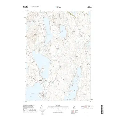
2018 Map of Raymond
USGS Topo · Published 2018About this map
Crescent Lake and Panther Pond dominate this landscape in Cumberland County, where the topography transitions from the waters of Sebago Lake in the south toward the rises of Rattlesnake Mtn and Pismire Mtn in the north. The settlement of Raymond serves as a central hub, while smaller communities like Suckerville, East Raymond, and North Raymond are scattered through the wooded hills and lakefronts. For genealogists, the map is particularly detailed, identifying numerous burial grounds including the Raymond Village Cem, Edwards Family Cem, and the Raymond Hill Baptist Church Cem.
Find a feature on this map
167 named features on this map. Tap any name to fly to it.
Don’t see what you’re looking for? This feature index may not catch every label — zoom into the map to look around manually.
Map Details
Editions of this 2018 Raymond Map
This is the sole edition of this map. No revisions or reprints were ever made.
Other maps of this area

1894 · Gray
USGS Topo · 1:62,500

1896 · Norway
USGS Topo · 1:62,500

1896 · Sebago
USGS Topo · 1:62,500

1898 · Gray
USGS Topo · 1:62,500

1908 · Poland
USGS Topo · 1:62,500

1940 · Poland
USGS Topo · 1:62,500

1942 · Poland
USGS Topo · 1:62,500

1942 · Gray
USGS Topo · 1:62,500

1942 · Sebago Lake
USGS Topo · 1:62,500

1943 · Sebago Lake
USGS Topo · 1:62,500