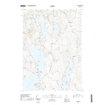
2021 Map of Raymond
USGS Topo · Published 2021About this map
Crescent Lake and Panther Pond dominate the central landscape of this Cumberland County region, where the terrain is defined by a dense network of inland waters and prominent heights like Rattlesnake Mtn and Raymond Hill. The settlement pattern reflects a long-established rural community, with clusters at East Raymond and North Raymond connected by historic corridors such as Webbs Mills Rd. For genealogists, the map is particularly detailed, pinpointing numerous burial grounds including the Raymond Village Cem and the Raymond Hill Baptist Church/Cem. The southern portion of the sheet reveals the complex shoreline of Little Sebago Lake, featuring numerous named islands such as Spider Island and Martin Island. This 2021 update preserves the locations of old local landmarks like Suckerville and Glovers Wig while detailing the modern road network that services these lakefront communities.
Find a feature on this map
159 named features on this map. Tap any name to fly to it.
Don’t see what you’re looking for? This feature index may not catch every label — zoom into the map to look around manually.
Map Details
Editions of this 2021 Raymond Map
This is the sole edition of this map. No revisions or reprints were ever made.
Other maps of this area

1894 · Gray
USGS Topo · 1:62,500

1896 · Norway
USGS Topo · 1:62,500

1896 · Sebago
USGS Topo · 1:62,500

1898 · Gray
USGS Topo · 1:62,500

1908 · Poland
USGS Topo · 1:62,500

1940 · Poland
USGS Topo · 1:62,500

1942 · Poland
USGS Topo · 1:62,500

1942 · Gray
USGS Topo · 1:62,500

1942 · Sebago Lake
USGS Topo · 1:62,500

1943 · Sebago Lake
USGS Topo · 1:62,500