2022 Map of Raymond
USGS Topo · Published 2022About this map
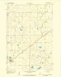
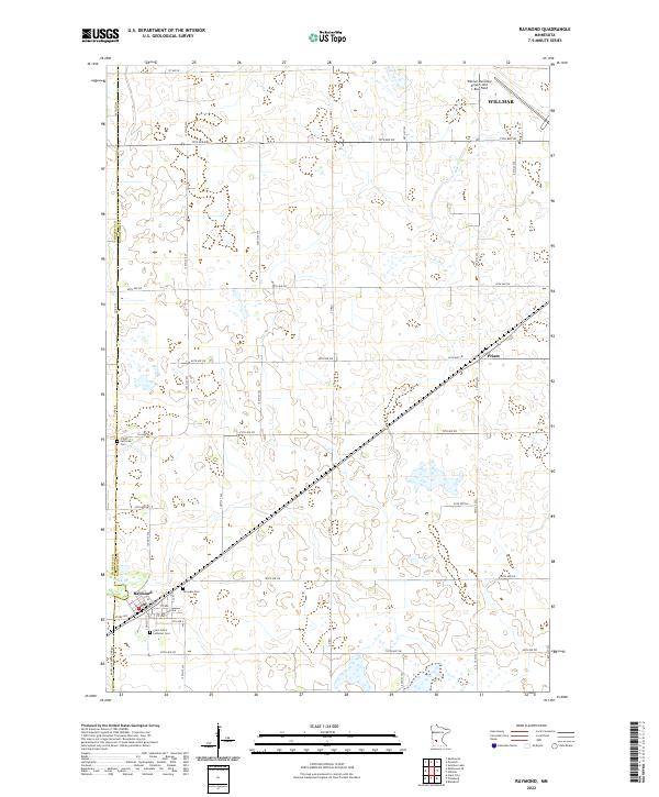
Raymond anchors the southwestern corner of this survey, a structured community defined by a grid including Babcock Ave, Cofield St S, and several numbered avenues. The surrounding landscape in this portion of Kandiyohi Co is a grid of agricultural section lines and township boundaries, including the divide between t119n r36w and t118n r36w. Traces of early settlement and community life are preserved in the locations of Fairview Cem, Trinity Lutheran Cem, and Saint John's Lutheran Cem, which sit alongside established rural roads like Co HWY 42. To the northeast, the outskirts of Willmar are visible near the Willmar Municipal Airport-John L Rice Field. A prominent rail line cuts diagonally across the prairie, passing through the small community of Priam as it links the larger regional hubs. The winding course of Hawk Cr provides the only significant break in the geometric regularity of the county's road network.
Find a feature on this map
46 named features on this map. Tap any name to fly to it.
Don’t see what you’re looking for? This feature index may not catch every label — zoom into the map to look around manually.
Map Details
Editions of this 2022 Raymond Map
This is the sole edition of this map. No revisions or reprints were ever made.