1958 Map of Raymond
USGS Topo · Published 1960About this map
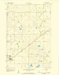
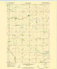
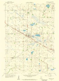
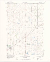
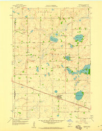
Great Northern rail lines cut diagonally across this prairie landscape, defining the development of southwestern Kandiyohi County in the late 1950s. The village of Raymond serves as the primary hub, showing a detailed street grid and a small cluster of structures near the tracks. To the northeast, the smaller settlement of Priam sits at a rail junction, illustrating how these transportation corridors dictated the placement of grain stops and community centers.
Find a feature on this map
14 named features on this map. Tap any name to fly to it.
Don’t see what you’re looking for? This feature index may not catch every label — zoom into the map to look around manually.
Map Details
Editions of this 1958 Raymond Map
2 editions found
Other maps of this area

1953 · New Ulm
USGS Topo · 1:250,000

1953 · Saint Cloud
USGS Topo · 1:250,000

1957 · Saint Cloud
USGS Topo · 1:250,000

1957 · New Ulm
USGS Topo · 1:250,000

1958 · New Ulm
USGS Topo · 1:250,000

1958 · Saint Cloud
USGS Topo · 1:250,000
1958 · Kerkhoven SE
USGS Topo · 1:24,000
1958 · Kerkhoven
USGS Topo · 1:24,000
1958 · Raymond
USGS Topo · 1:24,000
1958 · Pennock
USGS Topo · 1:24,000