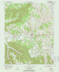
1953 Map of Raywick
USGS Topo · Published 1984About this map
Raywick sits at the heart of this mid-century landscape where the Rolling Fork carves a serpentine path through the knob country of central Kentucky. The topography is defined by sharp elevations like Flag Knob and Bald Knob, while the river creates dramatic geological features such as Horseshoe Bend. The era's rural infrastructure is well-documented, showing a network of ridge-top and valley-floor roads including Morris Road and the Louisville and Nashville rail line tracing the eastern edge. Local life is centered around small nodes of community and faith, such as Saint Francis and Saint Joseph, alongside educational landmarks like Highview Sch and Mt Washington Sch. The map also captures several family-named roads and burial sites, including the Sutton Cem and the St Francis Xavier Cem, reflecting the deep-rooted genealogical heritage of this Marion County river valley.
Find a feature on this map
36 named features on this map. Tap any name to fly to it.
Don’t see what you’re looking for? This feature index may not catch every label — zoom into the map to look around manually.
Map Details
Editions of this 1953 Raywick Map
3 editions found
Other maps of this area

1953 · Howardstown
USGS Topo · 1:24,000

1953 · Loretto
USGS Topo · 1:24,000

1953 · Saloma
USGS Topo · 1:24,000

1953 · Hibernia
USGS Topo · 1:24,000

1953 · Saint Catharine
USGS Topo · 1:24,000

1953 · New Haven
USGS Topo · 1:24,000

1953 · Raywick
USGS Topo · 1:24,000

1953 · Spurlington
USGS Topo · 1:24,000

1953 · Lebanon West
USGS Topo · 1:24,000

1957 · Winchester
USGS Topo · 1:250,000