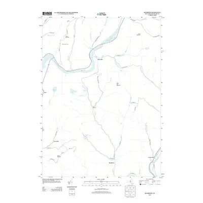
2013 Map of Readburn
USGS Topo · Published 2013About this map
Cannonsville Reservoir dominates the northern landscape of this Delaware County region, where the winding E Br Delaware River and the NYC RR corridor define the valley's transit history. The terrain is marked by significant elevations such as Tower Mountain and Rock Rift Mountain, with the Pines Lookout Tower standing as a sentinel over the western ridges. This 2013 survey provides a detailed look at the rural settlements of Rock Rift, Readburn, and Kerryville, tracing the networks of local roads like Dryden Rd and Kerryville Rd that connect isolated farmsteads and homes. For genealogists, the inclusion of the Read Creek Cem near Read Cr offers a specific point for local family research. The abundance of named water features, including Beaver Meadow Pond and numerous brooks like Chase Brook, illustrates a landscape heavily shaped by its watershed and mountainous topography.
Find a feature on this map
58 named features on this map. Tap any name to fly to it.
Don’t see what you’re looking for? This feature index may not catch every label — zoom into the map to look around manually.
Map Details
Editions of this 2013 Readburn Map
This is the sole edition of this map. No revisions or reprints were ever made.
Other maps of this area

1920 · Long Eddy
USGS Topo · 1:62,500

1921 · Long Eddy
USGS Topo · 1:48,000

1923 · Long Eddy
USGS Topo · 1:62,500

1923 · Walton
USGS Topo · 1:48,000

1924 · Starrucca
USGS Topo · 1:48,000

1924 · Deposit
USGS Topo · 1:62,500

1925 · Walton
USGS Topo · 1:62,500

1926 · Deposit
USGS Topo · 1:62,500

1926 · Starrucca
USGS Topo · 1:62,500

1930 · Starrucca
USGS Topo · 1:48,000