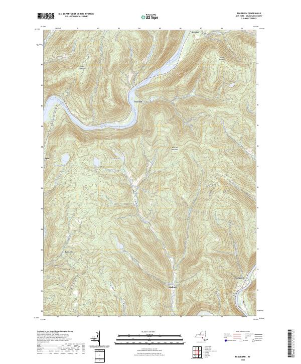
2023 Map of Readburn
USGS Topo · Published 2023About this map
Readburn and the small settlements of Beerston and Rock Rift are set against a landscape defined by the deep valleys and high summits of the Catskill Mountains. The West Branch Delaware River flows through the northern reaches of this area, partially contained by the Cannonsville Reservoir. This waterway is a central piece of regional infrastructure, linked to the West Delaware Aqueduct which passes beneath the terrain near Read Creek Cem.
Find a feature on this map
64 named features on this map. Tap any name to fly to it.
Don’t see what you’re looking for? This feature index may not catch every label — zoom into the map to look around manually.
Map Details
Editions of this 2023 Readburn Map
This is the sole edition of this map. No revisions or reprints were ever made.
Other maps of this area

1920 · Long Eddy
USGS Topo · 1:62,500

1921 · Long Eddy
USGS Topo · 1:48,000

1923 · Long Eddy
USGS Topo · 1:62,500

1923 · Walton
USGS Topo · 1:48,000

1924 · Starrucca
USGS Topo · 1:48,000

1924 · Deposit
USGS Topo · 1:62,500

1925 · Walton
USGS Topo · 1:62,500

1926 · Deposit
USGS Topo · 1:62,500

1926 · Starrucca
USGS Topo · 1:62,500

1930 · Starrucca
USGS Topo · 1:48,000