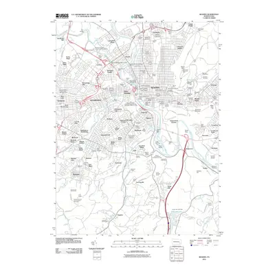
2010 Map of Reading
USGS Topo · Published 2010About this map
The Schuylkill River carves through the heart of this Pennsylvania urban and suburban landscape, flanked by the industrial and cultural history of Reading. On the eastern heights, Neversink Mountain and Mount Penn overlook a dense grid of neighborhoods, including the Centre Park Historic District and the legacy of the Reading Railroad Massacre Historic Marker. The map reveals a deep layering of community institutions, from the Pennsylvania State The University Berks Campus to numerous historic burial grounds like the Charles Evans Cemetery and Aulenbach Cemetery. South of the city, the land transitions to more open terrain, featuring the Sheerlund Forests and the Allegheny Aqueduct, illustrating the intersection of natural conservation and early transportation infrastructure along the river's path.
Find a feature on this map
182 named features on this map. Tap any name to fly to it.
Don’t see what you’re looking for? This feature index may not catch every label — zoom into the map to look around manually.
Map Details
Editions of this 2010 Reading Map
This is the sole edition of this map. No revisions or reprints were ever made.
Other maps of this area

1894 · Reading
USGS Topo · 1:62,500

1902 · Wernersville
USGS Topo · 1:62,500

1905 · Honey Brook
USGS Topo · 1:62,500

1906 · New Holland
USGS Topo · 1:62,500

1907 · Honeybrook
USGS Topo · 1:62,500

1908 · New Holland
USGS Topo · 1:62,500

1913 · Reading
USGS Topo · 1:62,500

1915 · Reading
USGS Topo · 1:62,500

1941 · Honeybrook
USGS Topo · 1:62,500

1941 · New Holland
USGS Topo · 1:62,500