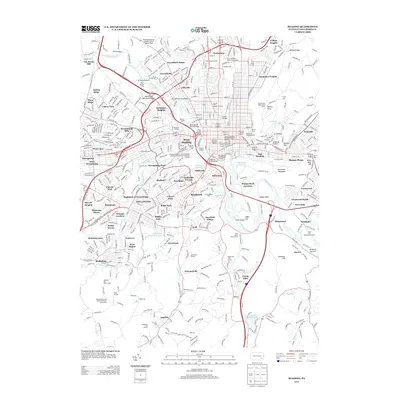
2013 Map of Reading
USGS Topo · Published 2013About this map
The Schuylkill River carves a deep path through this urban and suburban landscape, serving as the central artery for a complex network of bridges and historical markers. Along the river's edge, infrastructure such as the Penn Street Bridge and Bingaman Street Bridge connects the urban core of Reading with West Reading and Wyomissing Park. Cultural and historical memory is preserved at sites like the Reading Railroad Massacre Historic Marker and the Reading Area Fire Fighters Museum.
Find a feature on this map
108 named features on this map. Tap any name to fly to it.
Don’t see what you’re looking for? This feature index may not catch every label — zoom into the map to look around manually.
Map Details
Editions of this 2013 Reading Map
This is the sole edition of this map. No revisions or reprints were ever made.
Other maps of this area

1894 · Reading
USGS Topo · 1:62,500

1902 · Wernersville
USGS Topo · 1:62,500

1905 · Honey Brook
USGS Topo · 1:62,500

1906 · New Holland
USGS Topo · 1:62,500

1907 · Honeybrook
USGS Topo · 1:62,500

1908 · New Holland
USGS Topo · 1:62,500

1913 · Reading
USGS Topo · 1:62,500

1915 · Reading
USGS Topo · 1:62,500

1941 · Honeybrook
USGS Topo · 1:62,500

1941 · New Holland
USGS Topo · 1:62,500