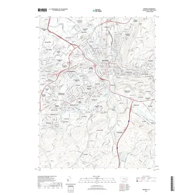
2019 Map of Reading
USGS Topo · Published 2019About this map
Reading and its sprawling suburban counterparts appear in high detail at the end of the second decade of the 21st century. The Schuylkill River defines the city's western edge, crossed by the Schuylkill Valley Bridge and Askew Bridge, while the Lindbergh Viaduct spans the landscape to the east near Mt Penn. This map provides a clear look at the region’s dense institutional footprint, including Albright College, Reading Area Community College, and Penn State Berks.
Find a feature on this map
128 named features on this map. Tap any name to fly to it.
Don’t see what you’re looking for? This feature index may not catch every label — zoom into the map to look around manually.
Map Details
Editions of this 2019 Reading Map
This is the sole edition of this map. No revisions or reprints were ever made.
Other maps of this area

1894 · Reading
USGS Topo · 1:62,500

1902 · Wernersville
USGS Topo · 1:62,500

1905 · Honey Brook
USGS Topo · 1:62,500

1906 · New Holland
USGS Topo · 1:62,500

1907 · Honeybrook
USGS Topo · 1:62,500

1908 · New Holland
USGS Topo · 1:62,500

1913 · Reading
USGS Topo · 1:62,500

1915 · Reading
USGS Topo · 1:62,500

1941 · Honeybrook
USGS Topo · 1:62,500

1941 · New Holland
USGS Topo · 1:62,500