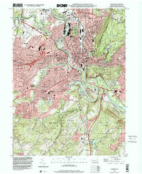
1999 Map of Reading
USGS Topo · Published 2001About this map
The Schuylkill River carves a sharp path through the heart of the region, defining the industrial and urban orientation of Reading and its surrounding boroughs. This late-twentieth-century landscape illustrates a dense network of educational and religious institutions, from Sacred Heart Sch to the campus of Penn State University, reflecting the social development of Berks County. To the west, Van Reeds Mill stands as a reminder of earlier water-powered industry along Tulpehocken Creek, while the expansive Reading Municipal General Carl A Spaatz Field to the north signals the area's modern infrastructure.
Find a feature on this map
77 named features on this map. Tap any name to fly to it.
Don’t see what you’re looking for? This feature index may not catch every label — zoom into the map to look around manually.
Map Details
Editions of this 1999 Reading Map
This is the sole edition of this map. No revisions or reprints were ever made.
Other maps of this area

1894 · Reading
USGS Topo · 1:62,500

1902 · Wernersville
USGS Topo · 1:62,500

1905 · Honey Brook
USGS Topo · 1:62,500

1906 · New Holland
USGS Topo · 1:62,500

1907 · Honeybrook
USGS Topo · 1:62,500

1908 · New Holland
USGS Topo · 1:62,500

1913 · Reading
USGS Topo · 1:62,500

1915 · Reading
USGS Topo · 1:62,500

1941 · Honeybrook
USGS Topo · 1:62,500

1941 · New Holland
USGS Topo · 1:62,500