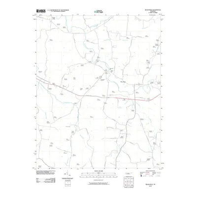
2010 Map of Readyville
USGS Topo · Published 2010About this map
Readyville Mill stands as a focal point in this landscape where the East Fork Stones River meets several significant tributaries. The terrain is defined by a series of prominent elevations, including Talley Hill, Pilot Knob, and Peaks Hill, which overlook a dense network of family cemeteries and rural homesteads. This 2010 survey reveals a deeply rooted settlement pattern, particularly at The Corners and New Hope, where long-established road systems like Halls Hill Pike and the John Bragg Hwy connect the various river forks. Genealogists will find a high concentration of burial sites, from the McKnight-Wright Cemetery in the north to the Todd Cemetery in the south. The prevalence of named crossings like Gooch Ford and the winding paths of Brawleys Fork and Cripple Creek illustrate the enduring influence of the river system on the area's geography and history.
Find a feature on this map
99 named features on this map. Tap any name to fly to it.
Don’t see what you’re looking for? This feature index may not catch every label — zoom into the map to look around manually.
Map Details
Editions of this 2010 Readyville Map
This is the sole edition of this map. No revisions or reprints were ever made.
Other maps of this area

1908 · Woodbury
USGS Topo · 1:62,500

1913 · Hollow Springs
USGS Topo · 1:62,500

1916 · Murfreesboro
USGS Topo · 1:62,500

1936 · Webbs Jungle
USGS Topo · 1:24,000

1936 · Beech Grove
USGS Topo · 1:24,000

1936 · Petty Gap
USGS Topo · 1:24,000

1942 · Statesville
USGS Topo · 1:100,000

1942 · Lebanon
USGS Topo · 1:100,000

1943 · Mc Minnville
USGS Topo · 1:100,000

1944 · Shelbyville
USGS Topo · 1:100,000