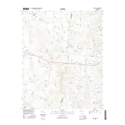
2016 Map of Readyville
USGS Topo · Published 2016About this map
The East Fork Stones River carves through this central Tennessee landscape, following the divide between Rutherford Co and Cannon Co. The village of Readyville serves as a local hub near the river's path, situated along the historic corridor of Murfreesboro Rd. This area is characterized by a high density of family cemeteries, such as the McKnight-Wright Cem and Wards Grove Cem, which suggest long-standing agricultural roots and deep genealogical ties. The terrain rises to distinct summits like Talley Hill, Pilot Knob, and Peaks Hill, while several minor watercourses like Cripple Creek and Brawleys Fork drain the surrounding hollows. Smaller settlements such as Kittrell, Halls Hill, and Culpepper anchor the surrounding rural road network, which is dominated by traditional pikes and namesake routes like Halls Hill Pike and Old Woodbury Pike.
Find a feature on this map
132 named features on this map. Tap any name to fly to it.
Don’t see what you’re looking for? This feature index may not catch every label — zoom into the map to look around manually.
Map Details
Editions of this 2016 Readyville Map
This is the sole edition of this map. No revisions or reprints were ever made.
Other maps of this area

1908 · Woodbury
USGS Topo · 1:62,500

1913 · Hollow Springs
USGS Topo · 1:62,500

1916 · Murfreesboro
USGS Topo · 1:62,500

1936 · Webbs Jungle
USGS Topo · 1:24,000

1936 · Beech Grove
USGS Topo · 1:24,000

1936 · Petty Gap
USGS Topo · 1:24,000

1942 · Statesville
USGS Topo · 1:100,000

1942 · Lebanon
USGS Topo · 1:100,000

1943 · Mc Minnville
USGS Topo · 1:100,000

1944 · Shelbyville
USGS Topo · 1:100,000