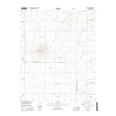
2014 Map of Red Butte
USGS Topo · Published 2014About this map
Red Butte stands as a prominent landmark above the Coconino Plateau in this northern Arizona landscape. The area is characterized by a sophisticated water management network designed for ranching or forestry within the Kaibab National Forest. Features such as the Dillman Trick Tank, Nagiller Tank, and Huff Reservoir illustrate the critical nature of water storage in this arid environment. The map shows several seasonal drainages, including Little Red Horse Wash and Blue Stem Wash, which feed into various tanks and reservoirs like the Corbitt Dam Reservoir.
Find a feature on this map
40 named features on this map. Tap any name to fly to it.
Don’t see what you’re looking for? This feature index may not catch every label — zoom into the map to look around manually.
Map Details
Editions of this 2014 Red Butte Map
This is the sole edition of this map. No revisions or reprints were ever made.
Other maps of this area

1886 · San Francisco Mtns
USGS Topo · 1:250,000

1886 · Chino
USGS Topo · 1:250,000

1891 · San Francisco Mtns
USGS Topo · 1:250,000

1891 · Chino
USGS Topo · 1:250,000

1894 · San Francisco Mtns
USGS Topo · 1:250,000

1899 · San Francisco Mtns
USGS Topo · 1:250,000

1947 · Flagstaff
USGS Topo · 1:250,000

1948 · Williams
USGS Topo · 1:250,000

1954 · Flagstaff
USGS Topo · 1:250,000

1954 · Williams
USGS Topo · 1:250,000