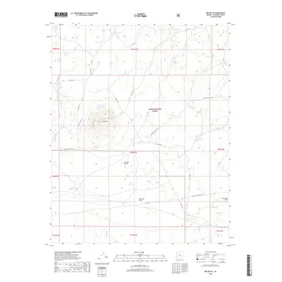
2018 Map of Red Butte
USGS Topo · Published 2018About this map
Red Butte rises as a prominent landmark above the surrounding high-desert terrain of the Coconino Plateau, serving as the central topographical focus of this portion of the Kaibab National Forest. The landscape is defined by an intricate network of drainage washes and vital water catchment points, known locally as tanks. These features, including Nagiller Tank, Airport Tank, and the family-named Curley Wallace Tank, trace the historical reliance on collected surface water in this arid Arizona environment. Transportation and utility corridors carve through the forest, notably the Old "304" Rd. and the modern APS 500 K.V. Powerline Rd. Smaller infrastructure such as Huff Reservoir and the Corbett Dam Reservoir indicate managed water resources that supported ranching or local forestry operations during this era.
Find a feature on this map
40 named features on this map. Tap any name to fly to it.
Don’t see what you’re looking for? This feature index may not catch every label — zoom into the map to look around manually.
Map Details
Editions of this 2018 Red Butte Map
This is the sole edition of this map. No revisions or reprints were ever made.
Other maps of this area

1886 · San Francisco Mtns
USGS Topo · 1:250,000

1886 · Chino
USGS Topo · 1:250,000

1891 · San Francisco Mtns
USGS Topo · 1:250,000

1891 · Chino
USGS Topo · 1:250,000

1894 · San Francisco Mtns
USGS Topo · 1:250,000

1899 · San Francisco Mtns
USGS Topo · 1:250,000

1947 · Flagstaff
USGS Topo · 1:250,000

1948 · Williams
USGS Topo · 1:250,000

1954 · Flagstaff
USGS Topo · 1:250,000

1954 · Williams
USGS Topo · 1:250,000