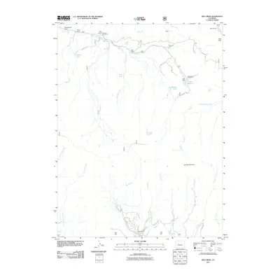
2011 Map of Red Creek
USGS Topo · Published 2011About this map
Red Table Mountain dominates this high-country landscape, where the headwaters of numerous creeks diverge across the terrain. Public recreation and water management are central to the area's modern character, centered around the Lede Reservoir and the Lede Reservoir Campground. The map details a complex drainage network including Gypsum Creek, Red Creek, and Antones Cabin Creek, which flow through steep-sided features like Schoolhouse Gulch and Hells Hole. Evidence of seasonal habitation and historical land use appears in labels like Antones Spring and Alldred Spring, providing specific points of interest for researchers of local water rights and land development. The southern portion of the sheet transitions toward the Ruedi Reservoir drainage, showing the influence of late 20th-century water infrastructure on this part of Eagle County.
Find a feature on this map
40 named features on this map. Tap any name to fly to it.
Don’t see what you’re looking for? This feature index may not catch every label — zoom into the map to look around manually.
Map Details
Editions of this 2011 Red Creek Map
This is the sole edition of this map. No revisions or reprints were ever made.
Other maps of this area

1909 · Mount Jackson
USGS Topo · 1:125,000

1911 · Mount Jackson
USGS Topo · 1:125,000

1957 · Leadville
USGS Topo · 1:250,000

1959 · Leadville
USGS Topo · 1:250,000

1960 · Leadville
USGS Topo · 1:250,000
1961 · Woody Creek
USGS Topo · 1:24,000

1961 · Ruedi
USGS Topo · 1:24,000
1961 · Toner Reservoir
USGS Topo · 1:24,000

1961 · Red Creek
USGS Topo · 1:24,000

1962 · Leadville
USGS Topo · 1:250,000