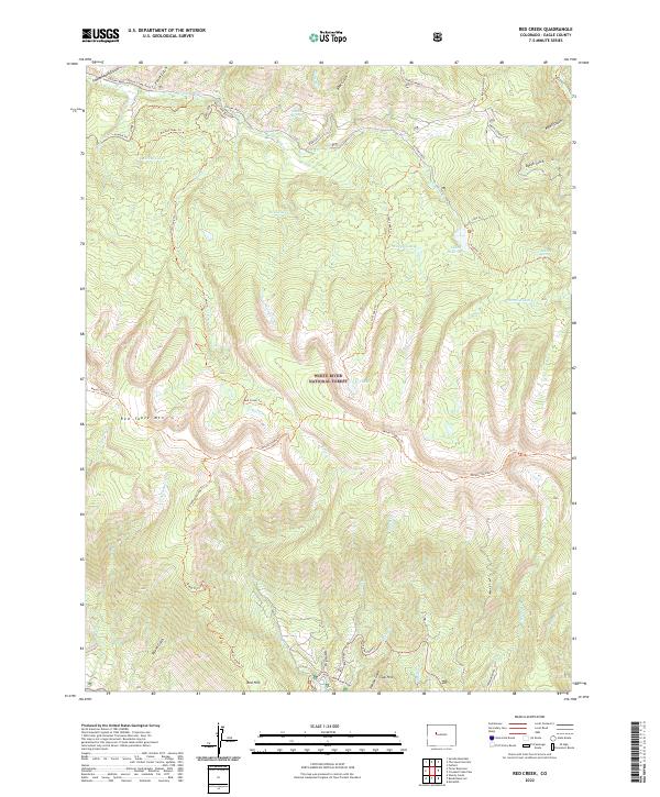
2022 Map of Red Creek
USGS Topo · Published 2022About this map
The White River National Forest defines this high-elevation landscape in Eagle County, dominated by the massive profile of Red Table Mtn. This terrain is deeply etched by a network of drainage systems, including the north-flowing Gypsum Creek and Campbell Creek. The presence of several distinct water bodies, such as the Lede Reservoir and the Rugged Lakes, indicates a landscape shaped by both natural basins and water management for the surrounding region.
Find a feature on this map
58 named features on this map. Tap any name to fly to it.
Don’t see what you’re looking for? This feature index may not catch every label — zoom into the map to look around manually.
Map Details
Editions of this 2022 Red Creek Map
This is the sole edition of this map. No revisions or reprints were ever made.
Other maps of this area

1909 · Mount Jackson
USGS Topo · 1:125,000

1911 · Mount Jackson
USGS Topo · 1:125,000

1957 · Leadville
USGS Topo · 1:250,000

1959 · Leadville
USGS Topo · 1:250,000

1960 · Leadville
USGS Topo · 1:250,000
1961 · Woody Creek
USGS Topo · 1:24,000

1961 · Ruedi
USGS Topo · 1:24,000
1961 · Toner Reservoir
USGS Topo · 1:24,000

1961 · Red Creek
USGS Topo · 1:24,000

1962 · Leadville
USGS Topo · 1:250,000