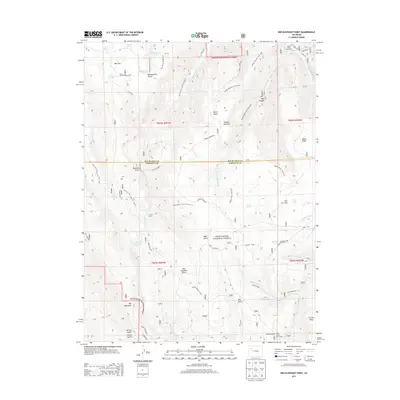
2013 Map of Red Elephant Point
USGS Topo · Published 2013About this map
White River National Forest encompasses much of this high-elevation landscape, where the headwaters of numerous creeks carve through the terrain of Middle Mountain and Coulter Mesa. The map documents a working landscape of the early 21st century, defined by remote outposts like Miller Creek Cow Camp and T I Cow Camp and an extensive network of trails such as Wagon Road and the Red Elephant Cutoff. High-country water sources are frequent, ranging from natural features like Machine Spring and Bloodsworth Pond to man-made structures like Howey Reservoir.
Find a feature on this map
58 named features on this map. Tap any name to fly to it.
Don’t see what you’re looking for? This feature index may not catch every label — zoom into the map to look around manually.
Map Details
Editions of this 2013 Red Elephant Point Map
This is the sole edition of this map. No revisions or reprints were ever made.
Other maps of this area

1906 · Grand Hogback
USGS Topo · 1:125,000

1910 · Grand Hogback
USGS Topo · 1:125,000

1952 · Rio Blanco
USGS Topo · 1:24,000

1952 · Horse Mountain
USGS Topo · 1:24,000

1957 · Leadville
USGS Topo · 1:250,000

1959 · Leadville
USGS Topo · 1:250,000

1960 · Leadville
USGS Topo · 1:250,000

1962 · Leadville
USGS Topo · 1:250,000

1964 · Leadville
USGS Topo · 1:250,000
1966 · Thirteenmile Creek
USGS Topo · 1:24,000