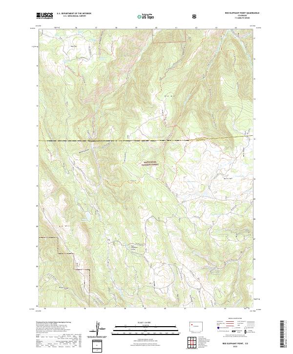
2022 Map of Red Elephant Point
USGS Topo · Published 2022About this map
White River National Forest lands dominate this high-country landscape along the border of Rio Blanco and Garfield Counties. The terrain is defined by dramatic elevation changes, rising from deep canyons like Buckskin Gulch and Red Canyon to the heights of Big Mtn and Mid Mtn. Water resources are scattered throughout the alpine environment, with named reservoirs such as Howey Reservoir and isolated alpine lakes like Trojan Lake and Buckskin Lake providing critical water in this arid climate.
Find a feature on this map
61 named features on this map. Tap any name to fly to it.
Don’t see what you’re looking for? This feature index may not catch every label — zoom into the map to look around manually.
Map Details
Editions of this 2022 Red Elephant Point Map
This is the sole edition of this map. No revisions or reprints were ever made.
Other maps of this area

1906 · Grand Hogback
USGS Topo · 1:125,000

1910 · Grand Hogback
USGS Topo · 1:125,000

1952 · Rio Blanco
USGS Topo · 1:24,000

1952 · Horse Mountain
USGS Topo · 1:24,000

1957 · Leadville
USGS Topo · 1:250,000

1959 · Leadville
USGS Topo · 1:250,000

1960 · Leadville
USGS Topo · 1:250,000

1962 · Leadville
USGS Topo · 1:250,000

1964 · Leadville
USGS Topo · 1:250,000
1966 · Thirteenmile Creek
USGS Topo · 1:24,000