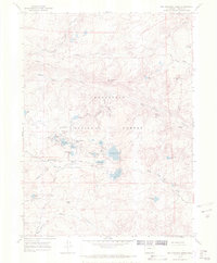
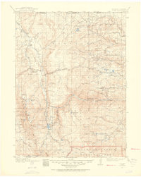
1967 Map of Red Feather Lakes
USGS Topo · Published 1971About this map
Red Feather Lakes serves as the focal point of this mountainous landscape within the Roosevelt National Forest, where a complex network of small lakes and water management systems defines the local character. The presence of the Red Feather Supply Ditch and the Bellaire Ditch illustrates the early engineering required to sustain this high-altitude community. Faith and community life are anchored by the Chapel In the Pines and Our Lady of the Lakes Ch, while the surrounding terrain is marked by distinctive elevations like Many Thunders Mountain and Mount Margaret. To the east, the Prairie Divide and ranching operations such as the Maxwell Ranch suggest a transition toward more open grazing lands. Numerous named water bodies, including Parvin Lake, Dowdy Lake, and Lady Moon Lake, highlight the area's development as a central recreation and conservation hub in Larimer County.
Find a feature on this map
49 named features on this map. Tap any name to fly to it.
Don’t see what you’re looking for? This feature index may not catch every label — zoom into the map to look around manually.
Map Details
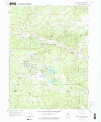
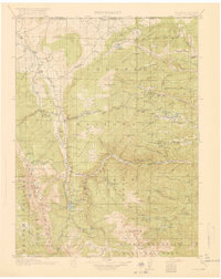
Editions of this 1967 Red Feather Lakes Map
2 editions found
Other maps of this area
1907 · Livermore
USGS Topo · 1:125,000
1909 · Livermore
USGS Topo · 1:125,000
1916 · Home
USGS Topo · 1:125,000
1920 · Home
USGS Topo · 1:125,000

1954 · Greeley
USGS Topo · 1:250,000

1957 · Greeley
USGS Topo · 1:250,000

1958 · Greeley
USGS Topo · 1:250,000
1960 · Haystack Gulch
USGS Topo · 1:24,000

1961 · Greeley
USGS Topo · 1:250,000
1962 · Kinikinik
USGS Topo · 1:24,000