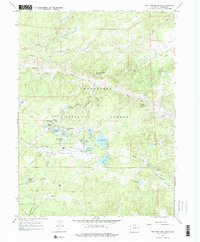
1967 Map of Red Feather Lakes
USGS Topo · Published 1975About this map
Red Feather Lakes sits at the heart of this high-country landscape, serving as a hub for a network of alpine reservoirs and irrigation projects within the Roosevelt National Forest. The map documents a community defined by its lakes, including Dowdy Lake, West Lake, and Hiawatha Lake, alongside civic landmarks like Our Lady of the Lakes Ch and the Chapel In The Pines. The distribution of residential clusters and campgrounds suggests a well-established seasonal and mountain-living economy by the late 1960s.
Find a feature on this map
54 named features on this map. Tap any name to fly to it.
Don’t see what you’re looking for? This feature index may not catch every label — zoom into the map to look around manually.
Map Details
Editions of this 1967 Red Feather Lakes Map
2 editions found
Other maps of this area

1907 · Livermore
USGS Topo · 1:125,000

1909 · Livermore
USGS Topo · 1:125,000

1916 · Home
USGS Topo · 1:125,000

1920 · Home
USGS Topo · 1:125,000

1954 · Greeley
USGS Topo · 1:250,000

1957 · Greeley
USGS Topo · 1:250,000

1958 · Greeley
USGS Topo · 1:250,000

1960 · Haystack Gulch
USGS Topo · 1:24,000

1961 · Greeley
USGS Topo · 1:250,000

1962 · Kinikinik
USGS Topo · 1:24,000