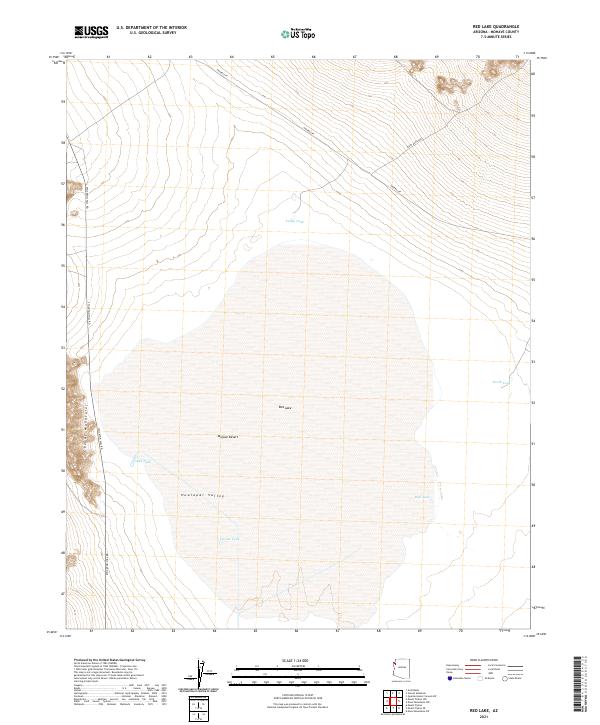
2021 Map of Red Lake
USGS Topo · Published 2021About this map
The Red Lake dry bed dominates the center of this 2021 survey of the northern Mojave Desert within the Hualapai Valley. To the west, the foothills of the Cerbat Mountains rise sharply, creating a distinct topographical contrast with the flat desert floor. This landscape is defined by the vital network of water catchment features necessary for desert life and livestock, including Valley Tank, Lake Tank, and Well Tank. The infrastructure of the area is represented by primitive and secondary access routes such as Tenny Ranch Rd, Anteras Pt, and Stockton Hill Rd, which provide the only passage through this arid stretch of Mohave County.
Find a feature on this map
16 named features on this map. Tap any name to fly to it.
Don’t see what you’re looking for? This feature index may not catch every label — zoom into the map to look around manually.
Map Details
Editions of this 2021 Red Lake Map
This is the sole edition of this map. No revisions or reprints were ever made.
Other maps of this area

1886 · Diamond Creek
USGS Topo · 1:250,000

1886 · Camp Mohave
USGS Topo · 1:250,000

1892 · Diamond Creek
USGS Topo · 1:250,000

1892 · Camp Mohave
USGS Topo · 1:250,000

1942 · Camp Mohave
USGS Topo · 1:250,000

1947 · Kingman
USGS Topo · 1:250,000

1948 · Kingman
USGS Topo · 1:250,000

1948 · Williams
USGS Topo · 1:250,000

1954 · Kingman
USGS Topo · 1:250,000

1954 · Williams
USGS Topo · 1:250,000