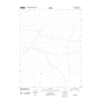
2011 Map of Red Ridge
USGS Topo · Published 2011About this map
The high desert landscape of Churchill County is dominated here by the linear landform of Red Ridge, which trends through the southern half of the quadrangle. This 2011 survey, incorporating imagery from the National Agricultural Imagery Program and digital data from the National Hydrography Dataset, reflects a modern topographical study of the arid Great Basin environment. While the map is sparse of named settlements, the intricate network of desert washes and drainage patterns provides a clear view of the hydrological character of this portion of Nevada. The terrain data, based on the National Elevation Dataset from 2001, helps researchers visualize the subtle elevations and natural corridors that define the area's physical geography.
Find a feature on this map
1 named feature on this map. Tap any name to fly to it.
Don’t see what you’re looking for? This feature index may not catch every label — zoom into the map to look around manually.
Map Details
Editions of this 2011 Red Ridge Map
This is the sole edition of this map. No revisions or reprints were ever made.
Other maps of this area

1908 · Carson Sink
USGS Topo · 1:250,000

1909 · Hawthorne
USGS Topo · 1:250,000

1910 · Carson Sink
USGS Topo · 1:250,000

1911 · Hawthorne
USGS Topo · 1:250,000

1915 · Hawthorne
USGS Topo · 1:250,000

1948 · Walker Lake
USGS Topo · 1:250,000

1951 · Allen Springs
USGS Topo · 1:62,500

1957 · Walker Lake
USGS Topo · 1:250,000

1957 · Reno
USGS Topo · 1:250,000

1959 · Reno
USGS Topo · 1:250,000