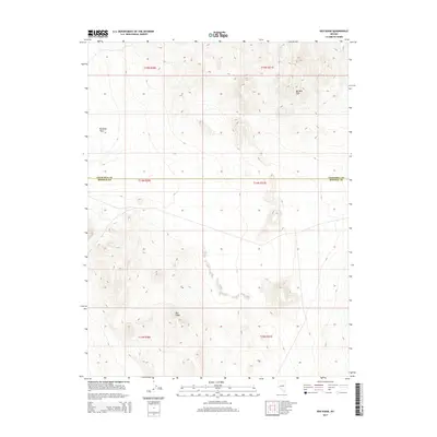
2014 Map of Red Ridge
USGS Topo · Published 2014About this map
Red Ridge and the Barnett Hills dominate this high-desert landscape in central Nevada. The terrain transitions from the stark, open expanse of Rawhide Flats in the northwest toward the more elevated, complex topography of the southeastern sections. This 2014 survey captures a sparsely populated region where the administrative boundary between Churchill County and Mineral County runs directly through the center of the sheet. The map is defined by its lack of established settlements, instead focusing on the dry basins and rugged rises typical of this part of the Great Basin. Large-scale land divisions, including portions of t15n r30e, t14n r30e, and t13n r30e, provide a framework for understanding the vast public land survey system that governs this isolated corridor.
Find a feature on this map
10 named features on this map. Tap any name to fly to it.
Don’t see what you’re looking for? This feature index may not catch every label — zoom into the map to look around manually.
Map Details
Editions of this 2014 Red Ridge Map
This is the sole edition of this map. No revisions or reprints were ever made.
Other maps of this area

1908 · Carson Sink
USGS Topo · 1:250,000

1909 · Hawthorne
USGS Topo · 1:250,000

1910 · Carson Sink
USGS Topo · 1:250,000

1911 · Hawthorne
USGS Topo · 1:250,000

1915 · Hawthorne
USGS Topo · 1:250,000

1948 · Walker Lake
USGS Topo · 1:250,000

1951 · Allen Springs
USGS Topo · 1:62,500

1957 · Walker Lake
USGS Topo · 1:250,000

1957 · Reno
USGS Topo · 1:250,000

1959 · Reno
USGS Topo · 1:250,000