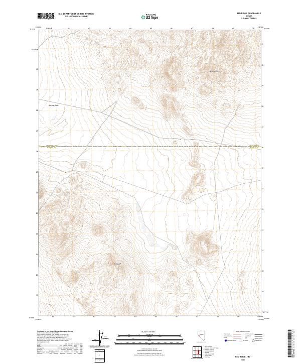
2021 Map of Red Ridge
USGS Topo · Published 2021About this map
The boundary between Churchill and Mineral County cuts across a high desert landscape defined by severe topography and wide alluvial plains. The namesake Red Ridge dominates the southern reaches of the quadrangle, while the elevations of the Barnett Hills rise to the northeast. Between these heights lies Rawhide Flats, a characteristic basin floor that illustrates the basin-and-range geography of this portion of Nevada. The map documents the section lines of the Public Land Survey System, including t14n r30e and t15n r31e, which provided the framework for land claims and mining activity in this arid region. The lack of surface water or established settlements underscores the logistical challenges of the terrain at the time of this survey.
Find a feature on this map
10 named features on this map. Tap any name to fly to it.
Don’t see what you’re looking for? This feature index may not catch every label — zoom into the map to look around manually.
Map Details
Editions of this 2021 Red Ridge Map
This is the sole edition of this map. No revisions or reprints were ever made.
Other maps of this area

1908 · Carson Sink
USGS Topo · 1:250,000

1909 · Hawthorne
USGS Topo · 1:250,000

1910 · Carson Sink
USGS Topo · 1:250,000

1911 · Hawthorne
USGS Topo · 1:250,000

1915 · Hawthorne
USGS Topo · 1:250,000

1948 · Walker Lake
USGS Topo · 1:250,000

1951 · Allen Springs
USGS Topo · 1:62,500

1957 · Walker Lake
USGS Topo · 1:250,000

1957 · Reno
USGS Topo · 1:250,000

1959 · Reno
USGS Topo · 1:250,000