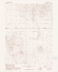
1987 Map of Red Ridge
USGS Topo · Published 1987About this map
The Walker River Indian Reservation occupies the central and southern portions of this Nevada survey, a landscape defined by desert basins and high-relief terrain. The geography is dominated by the Barnett Hills to the north and the namesake Red Ridge to the south, with the wide expanse of Rawhide Flats bridging the two. This 1980s-era documentation highlights a history of extraction and transportation, evidenced by an Old Railroad Grade cutting across the flats. Evidence of mineral exploration is scattered throughout the region, with specific markings for a Mine, multiple Prospect sites, and an Adit tucked into the slopes. These features, alongside several Dry Lake beds, reflect the arid environment and the industrial efforts to navigate and utilize this stretch of the Churchill and Mineral County border.
Find a feature on this map
10 named features on this map. Tap any name to fly to it.
Don’t see what you’re looking for? This feature index may not catch every label — zoom into the map to look around manually.
Map Details
Editions of this 1987 Red Ridge Map
This is the sole edition of this map. No revisions or reprints were ever made.
Other maps of this area

1908 · Carson Sink
USGS Topo · 1:250,000

1909 · Hawthorne
USGS Topo · 1:250,000

1910 · Carson Sink
USGS Topo · 1:250,000

1911 · Hawthorne
USGS Topo · 1:250,000

1915 · Hawthorne
USGS Topo · 1:250,000

1948 · Walker Lake
USGS Topo · 1:250,000

1951 · Allen Springs
USGS Topo · 1:62,500

1957 · Walker Lake
USGS Topo · 1:250,000

1957 · Reno
USGS Topo · 1:250,000

1959 · Reno
USGS Topo · 1:250,000