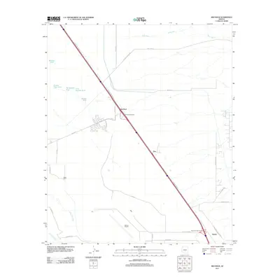
2011 Map of Red Rock
USGS Topo · Published 2011About this map
Red Rock and the surrounding Pinal and Pima County desert landscape are defined by a complex network of water management and transit infrastructure. The Santa Cruz River and Los Robles Wash anchor the drainage system, supplemented by numerous man-made features like Number Three Tank and Big Spreader Tank, which reflect the region's reliance on managed water for ranching and agriculture. The settlement of Meeks Ranch sits in the lower basin, while the high-speed transit corridor of Camino Adelante bisects the terrain.
Find a feature on this map
35 named features on this map. Tap any name to fly to it.
Don’t see what you’re looking for? This feature index may not catch every label — zoom into the map to look around manually.
Map Details
Editions of this 2011 Red Rock Map
This is the sole edition of this map. No revisions or reprints were ever made.
Other maps of this area

1934 · Tucson Mountains
USGS Topo · 1:125,000

1934 · Newman Peak
USGS Topo · 1:125,000

1947 · Cortaro
USGS Topo · 1:62,500

1947 · Red Rock
USGS Topo · 1:62,500

1956 · Tucson
USGS Topo · 1:250,000

1957 · Cortaro
USGS Topo · 1:62,500

1958 · Tucson
USGS Topo · 1:250,000

1959 · Tucson
USGS Topo · 1:250,000

1959 · Tortolita Mts
USGS Topo · 1:62,500
1959 · Silver Bell Peak
USGS Topo · 1:62,500