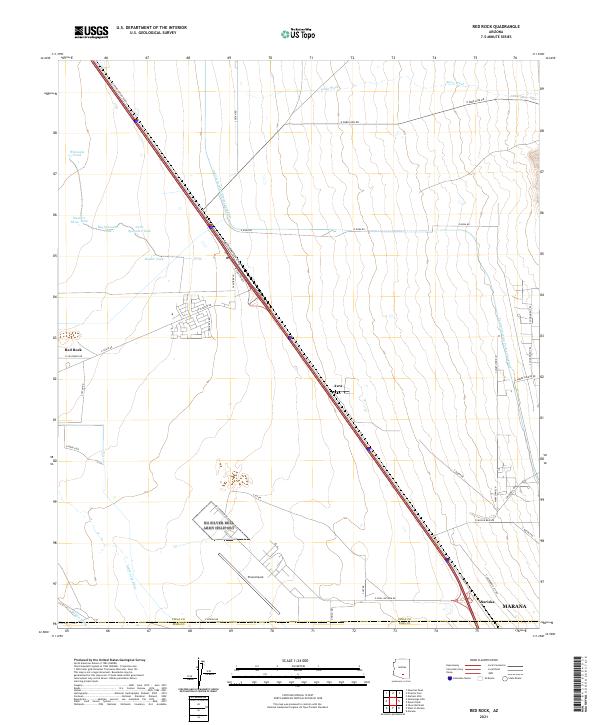
2021 Map of Red Rock
USGS Topo · Published 2021About this map
Pinal Airpark stands as a significant landmark in this desert corridor between Phoenix and Tucson, marking a landscape defined by aviation and water infrastructure. The modern course of the Central Arizona Project Aqueduct cuts diagonally through the terrain, illustrating the critical engineering required to manage water resources in the Pinal County arid lands. Traditional drainage is still visible through the Santa Cruz River and Suizo Wash, alongside smaller water catchments like Wilmonts Pond and Big Spreader Tank. Small communities and rail-adjacent points including Red Rock, Avra, and Nariska are situated along the major transportation artery of E Camino Adelante Rd. The map also captures the transition from Pinal into Pima County, showing the northern edges of Marana and a network of specialized local roads such as E Missile Base Rd, hinting at the region's mid-century defense and aerospace legacy.
Find a feature on this map
46 named features on this map. Tap any name to fly to it.
Don’t see what you’re looking for? This feature index may not catch every label — zoom into the map to look around manually.
Map Details
Editions of this 2021 Red Rock Map
This is the sole edition of this map. No revisions or reprints were ever made.
Other maps of this area

1934 · Tucson Mountains
USGS Topo · 1:125,000

1934 · Newman Peak
USGS Topo · 1:125,000

1947 · Cortaro
USGS Topo · 1:62,500

1947 · Red Rock
USGS Topo · 1:62,500

1956 · Tucson
USGS Topo · 1:250,000

1957 · Cortaro
USGS Topo · 1:62,500

1958 · Tucson
USGS Topo · 1:250,000

1959 · Tucson
USGS Topo · 1:250,000

1959 · Tortolita Mts
USGS Topo · 1:62,500
1959 · Silver Bell Peak
USGS Topo · 1:62,500