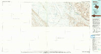
1992 Map of Redford
USGS Topo · Published 1993About this map
The Rio Grande serves as the central artery and international boundary in this early 1990s survey, dividing Presidio Co, Texas, from the Estados Unidos Mexicanos. Near the river's edge, the settlement of Redford sits at the base of the high, arid peaks of the Bofecillos Mountains. A network of intermittent drainages, including Arroyo Auras and Arroyo Burras, carve through the landscape toward the river. To the south, the terrain rises into the Sierra Tarahumara, while a local Levee suggests the critical management of seasonal water flow in this desert environment. This map highlights the stark contrast between the established topographic data of the American side and the Mexican interior, where information is less dense, providing a clear picture of the border region's physical geography before modern expansion.
Find a feature on this map
16 named features on this map. Tap any name to fly to it.
Don’t see what you’re looking for? This feature index may not catch every label — zoom into the map to look around manually.
Map Details
Editions of this 1992 Redford Map
This is the sole edition of this map. No revisions or reprints were ever made.
Other maps of this area

1896 · Ruidosa
USGS Topo · 1:125,000

1896 · Polvo
USGS Topo · 1:125,000

1896 · Shafter
USGS Topo · 1:125,000

1903 · Terlingua
USGS Topo · 1:125,000

1904 · Terlingua
USGS Topo · 1:125,000

1917 · Tascotal Mesa
USGS Topo · 1:62,500

1931 · Lajitas
USGS Topo · 1:62,500

1944 · Tascotal Mesa
USGS Topo · 1:62,500

1959 · Emory Peak
USGS Topo · 1:250,000

1959 · Presidio
USGS Topo · 1:250,000