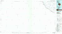
1985 Map of Redford
USGS Topo · Published 1985About this map
Redford sits along the northern bank of the Rio Grande in Presidio County, serving as a primary settlement in this arid borderland during the mid-1980s. The landscape is defined by the complex drainage of the Bofecillos Mountains, where numerous canyons like Bofecillos Canyon and Auras Canyon cut through the high desert toward the international boundary. High points such as Bofecillos Peak and Agua Adentro Mountain rise above the river valley, which is marked by essential water sources including Rancho Viejo Spring and Otto Spring. Highway 170 follows the river's winding path, connecting the remote outposts of this West Texas region near the Texas-Chihuahua border. The map illustrates a sparse but vital network of wells and springs that supported life and ranching in the shadow of peaks like Oso Mtn and Cerro de las Burras before the modern era.
Find a feature on this map
23 named features on this map. Tap any name to fly to it.
Don’t see what you’re looking for? This feature index may not catch every label — zoom into the map to look around manually.
Map Details
Editions of this 1985 Redford Map
This is the sole edition of this map. No revisions or reprints were ever made.
Other maps of this area

1896 · Ruidosa
USGS Topo · 1:125,000

1896 · Polvo
USGS Topo · 1:125,000

1896 · Shafter
USGS Topo · 1:125,000

1903 · Terlingua
USGS Topo · 1:125,000

1904 · Terlingua
USGS Topo · 1:125,000

1917 · Tascotal Mesa
USGS Topo · 1:62,500

1931 · Lajitas
USGS Topo · 1:62,500

1944 · Tascotal Mesa
USGS Topo · 1:62,500

1959 · Emory Peak
USGS Topo · 1:250,000

1959 · Presidio
USGS Topo · 1:250,000