
1917 Map of Tascotal Mesa
USGS Topo · Published 1917About this map
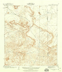
Isolated cattle ranches and rugged frontier trails dominate this 1917 survey of the High Desert borderlands. The landscape is defined by the massive uplift of Tascotal Mesa and the expansive Green Valley, where family operations like Rooney Ranch and Cotters Ranch established themselves in a territory carved by deep drainage systems like North Canyon and South Canyon. The map documents a critical transportation network for the era, including the Marfa and Lajitas Road and the historic Seminole Trail, which provided passage through the formidable terrain.
Find a feature on this map
32 named features on this map. Tap any name to fly to it.
Don’t see what you’re looking for? This feature index may not catch every label — zoom into the map to look around manually.
Map Details
Editions of this 1917 Tascotal Mesa Map
2 editions found
Other maps of this area

1896 · Polvo
USGS Topo · 1:125,000

1896 · Shafter
USGS Topo · 1:125,000

1903 · Terlingua
USGS Topo · 1:125,000

1904 · Terlingua
USGS Topo · 1:125,000

1917 · Agua Fria
USGS Topo · 1:62,500

1917 · Buck Hill
USGS Topo · 1:62,500

1918 · Buck Hill
USGS Topo · 1:62,500

1918 · Jordan Gap
USGS Topo · 1:62,500

1925 · Buck Hill
USGS Topo · 1:62,500

1930 · Jordan Gap
USGS Topo · 1:62,500