1959 Map of Presidio
USGS Topo · Published 1969About this map
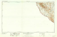
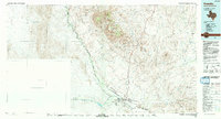
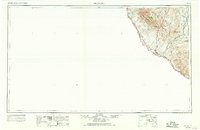
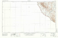
The Rio Grande defines the international boundary in this 1960s revision of the Big Bend region, where the high peaks of the Chinati Mountains and Cienega Mountains dominate the desert landscape. The mining history of the district is centered around the settlement of Shafter, situated near the Shafter Mine and Last Chance Mine. Transportation and commerce in the late 1950s followed a distinct pattern, with the Atchison Topeka and Santa Fe railroad corridor and local stops like Ocotillo Siding connecting the river settlements to the interior. Historic sites along the river include the Old Fort Leaton (ruins) and small river communities such as Adobes, Indio, and Redford. This survey provides a record of the remote borderlands before further modernization, highlighting a network of isolated ranches and rugged terrain between Cibolo Creek and the river valley.
Find a feature on this map
31 named features on this map. Tap any name to fly to it.
Don’t see what you’re looking for? This feature index may not catch every label — zoom into the map to look around manually.
Map Details
Editions of this 1959 Presidio Map
2 editions found
Historical Maps of Presidio Through Time
4 maps found