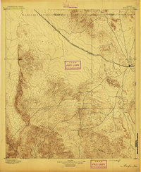
1895 Map of Marfa
USGS Topo · Published 1895About this map
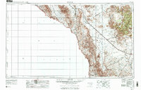
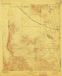
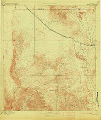
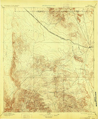
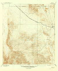
Marfa sits at the eastern edge of this late nineteenth-century survey, serving as a hub for the high-altitude Trans-Pecos region. The landscape is dominated by the Southern Pacific R. R., which cuts northwest across the broad Ryan Flat toward Ryan. This iron corridor facilitated the movement of goods and people between the ranching outposts and distant markets. Further south, the terrain becomes increasingly complex, marked by the prominent ridge of Cuesta Del Burro and the Cleveland Breaks. Scattered ranching outposts and waypoints such as Humphris, Bogel, and the Stage Stand hint at a pioneer economy reliant on intermittent water sources like Alamito Creek and Oak Creek. The map records a pivotal moment when rail-driven expansion began to reshape the vast pastoral reaches of Presidio and Jeff Davis counties.
Find a feature on this map
25 named features on this map. Tap any name to fly to it.
Don’t see what you’re looking for? This feature index may not catch every label — zoom into the map to look around manually.
Map Details
Editions of this 1895 Marfa Map
5 editions found
Historical Maps of Marfa Through Time
10 maps found