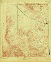
1895 Map of Marfa
USGS Topo · Published 1915About this map
Marfa serves as the focal point of this Trans-Pecos survey, situated at the junction of several critical overland routes and the Southern Pacific Galveston Harrisburg and San Antonio Div. railroad. The landscape is defined by broad basin floors like Ryan Flat and the complex topography of the Oak Hills and Cuesta Del Burro. These features directed the placement of vital water-dependent stops and ranches in an arid environment, where drainage systems like Alamita Creek and Long Draw shaped the path of early travel.
Find a feature on this map
25 named features on this map. Tap any name to fly to it.
Don’t see what you’re looking for? This feature index may not catch every label — zoom into the map to look around manually.
Map Details
Editions of this 1895 Marfa Map
5 editions found
Other maps of this area

1892 · Chispa
USGS Topo · 1:125,000

1894 · Valentine
USGS Topo · 1:125,000

1894 · Fort Davis
USGS Topo · 1:125,000

1895 · Chispa
USGS Topo · 1:125,000

1895 · Marfa
USGS Topo · 1:125,000

1895 · Alpine
USGS Topo · 1:125,000

1896 · Ruidosa
USGS Topo · 1:125,000

1896 · San Carlos
USGS Topo · 1:125,000

1896 · Shafter
USGS Topo · 1:125,000

1897 · Valentine
USGS Topo · 1:125,000