Old Maps of Jeff Davis County, Texas
Explore 351 old maps of Jeff Davis County, spanning from 1892 to today. These high-resolution historic maps reveal how streets, neighborhoods, landmarks, and natural features evolved over time — perfect for genealogy, metal detecting, research, and local history exploration.
What you can do with these maps:
- See how Jeff Davis County changed over time: Compare historical maps to modern-day views to trace roads, homesites, rail lines & more.
- View detailed metadata: Each map includes creators, publishers, year, scale, and archive source.
- Overlay maps with satellite & LiDAR: Visualize the past alongside modern tools to explore terrain & human change.
- Trusted historical sources: Maps sourced from the USGS, Library of Congress, and other archives.
- Access maps your way: View online, download high-res files, or order prints for personal or research use.
Start exploring old maps of Jeff Davis County to uncover forgotten places, hidden landmarks, and the deep history beneath your feet.
Jeff Davis County, TX maps
(351)- 1892 Map of Chispa, 1957 Print
 1892 Chispa1957 Print · USGSWest Texas railroad outposts and mountain passes are documented here in the final decade of the nineteenth century. Genealogists and historians can trace the early rail stops at Arno, Chispa, and Van Horn Wells along the original Southern Pacific line.
 - 1894 Map of Valentine, 1959 Print
 1894 Valentine1959 Print · USGSThe high peaks of West Texas come to life in this late-frontier survey of the Trans-Pecos ranching country. Researchers can trace the early rail influence at Valentine and locate numerous historic homesteads including Hardwicks Ranch and Newmans Ranch.
 - 1894 Map of Fort Davis, 1961 Print
 1894 Fort Davis1961 Print · USGSWest Texas in the late nineteenth century was a frontier of family ranching and vital springs. Genealogists and historians can trace the early locations of Fort Davis and numerous homesteads like Wards Ranch, Mahle's Ranch, and Huelster.
 - 1895 Map of Chispa
 1895 Chispa1895 Print · USGSWest Texas rail travel was in its prime during the late nineteenth century as steam engines traversed the mountain passes. Genealogists and rail historians can trace early sidings and stops like Van Horns Wells, Chispa, and the natural crossing at Vieja Pass.
 - 1895 Map of Marfa
 1895 Marfa1895 Print · USGSMarfa and the high desert plains of West Texas are captured here in the late nineteenth century as the railroad began to transform the frontier. Genealogists and historians can trace early outposts like Humphris, the Stage Stand, and the Southern Pacific R. R.5 unique versions available
 - 1895 Map of Alpine
 1895 Alpine1895 Print · USGSWest Texas ranching and rail life come into focus in the 1890s, centered on the growing hub of Alpine. Family historians can trace early landholdings like Greenlee Ranch and Neville Ranch alongside the vital Southern Pacific line.6 unique versions available
 - 1897 Map of Valentine
 1897 Valentine1897 Print · USGSThe Davis Mountains frontier and the railroad town of Valentine are shown here in the mid-1890s. Researchers can locate remote high-country outposts like Prude's Ranch and Newman's Ranch or trace the early course of the Southern Pacific R. R.6 unique versions available
 - 1897 Map of Fort Davis
 1897 Fort Davis1897 Print · USGSWest Texas ranching life and mountain topography are preserved in this 1890s survey centered on the frontier outpost of Fort Davis. Researchers can trace early family landholdings and essential water sites like Wards Ranch, Toyahvale, and Phantom Lake.3 unique versions available
 - 1897 Map of Chispa
 1897 Chispa1897 Print · USGSWest Texas rail culture and high-desert landscapes take center stage in the 1890s as steam power bridges the vast distances between the Rio Grande and the interior mountains. Genealogists and historians can trace the early rail stops at Chispa and Dalberg, or locate the critical water source at Van Horn Wells.3 unique versions available
 - 1921 Map of Toyah
 1921 Toyah1921 Print · USGSReeves County at the dawn of the highway era is documented here, showing the junction of major rail lines and early transcontinental motor routes. Researchers can trace family ranching history and railroad development through Toyah, Saragosa, and the VR Ranch.
 - 1928 Map of Kent
 1928 Kent1928 Print · USGSWest Texas ranching and rail life at the end of the 1920s are captured here as the region transitioned toward modern highway travel. Genealogists and historians can trace early outposts like Kent, family ranch sites such as Diamond Ranch, and the route of the Old Spanish Trail.
 - 1929 Map of Hovey
 1929 Hovey1929 Print · USGSIn the Trans-Pecos during the late twenties, the railroad and early motor trails dictated the rhythm of life across the mesa country. Researchers can trace the path of the Old Spanish Trail, locate rural stops like Chancellor, and identify family landmarks like Hayter and Williams.
 - 1943 Map of Valentine
 1943 Valentine1943 Print · USGSValentine and the Davis Mountains come alive in this mid-century look at the cattle and rail country of West Texas. Genealogists and historians can trace family-named holdings like Means Ranch Hdqrs., Prude's Ranch, and the isolated Foster Cabin.
 - 1954 Map of Van Horn, 1964 Print
 1954 Van Horn1964 Print · USGSThe Trans-Pecos region of West Texas comes into focus in the mid-1950s as a vital corridor of rail and desert commerce. Researchers can trace the path of the Texas and Pacific through Van Horn or locate remote rail sidings like Borracho and Laska Siding.2 unique versions available
 - 1954 Map of Pecos, 1964 Print
 1954 Pecos1964 Print · USGSMid-century West Texas reveals a landscape of expanding oil fields and cattle ranching along the winding Pecos River. Local historians can trace family ranch lands like Goodrich Ranch, follow the Texas and Pacific rails, or locate the historic Horsehead Crossing.3 unique versions available
 - 1954 Map of Fort Stockton, 1965 Print
 1954 Fort Stockton1965 Print · USGSWest Texas ranching and the early energy industry converge in this mid-century survey of the Trans-Pecos. Genealogists and historians can locate specific family lands like Graef Brothers Ranch and trace the paths of the Old Spanish Trail and the Southern Pacific railroad.3 unique versions available
 - 1957 Map of Pecos
 1957 Pecos1957 Print · USGSWest Texas in the mid-fifties is a landscape of desert oil fields and vital rail corridors. Researchers can trace the sprawling Pyote Air Force Base, the historic Horsehead Crossing, and the rail stops at Mentone and Saragosa.
 - 1958 Map of Van Horn
 1958 Van Horn1958 Print · USGSWest Texas ranching and rail history come alive in this 1950s survey of the Trans-Pecos desert during the era of major steam-to-diesel transition. Genealogists and historians can trace family-named outposts like Mayfield Ranch or locate the ruins of Presidio Viejo along the Rio Grande.
 - 1958 Map of Fort Stockton
 1958 Fort Stockton1958 Print · USGSThe Trans-Pecos region of West Texas in the late fifties is a landscape of vast mesas and isolated ranching hubs. Genealogists and historians can trace the paths of the Texas and New Orleans RR through Alpine or locate early settlements like Bakersfield and Sanderson.
 - 1959 Map of Marfa, 1976 Print
 1959 Marfa1976 Print · USGSThe Trans-Pecos frontier is captured here in the mid-twentieth century as cattle ranching and high-altitude science shaped the landscape. Researchers can trace the Southern Pacific rail line through Valentine or locate remote border outposts like Ruidosa and Indian Hot Springs Resort.2 unique versions available
 - 1965 Map of Marfa
 1965 Marfa1965 Print · USGSBig Bend ranching and high-desert rail travel come together in the 1960s along the Rio Grande and the southern reaches of the Davis Mountains. Researchers can trace the lineage of cattle outfits like Brite Ranch and historic stops like Valentine and Candelaria.
 - 1970 Map of Gomez Peak, 1973 Print
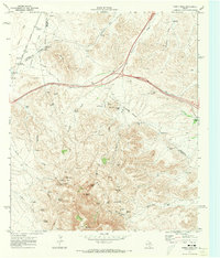 1970 Gomez Peak1973 Print · USGSThe High Desert ranchlands of West Texas are captured here at the start of the 1970s. Trace old family outfits and remote outposts like Dyer Camp, Cowden Ranch, and the Cowan Homestead among the peaks and springs.2 unique versions available
 - 1970 Map of Kent, 1973 Print
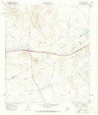 1970 Kent1973 Print · USGSNear the Apache Mountains in the early seventies, the Texas and Pacific railroad and local ranching interests define the landscape. Researchers can trace the layout of Kent, locate old water tanks like Lippy Tank, and find the Patterson settlement.
 - 1970 Map of Sotol Hill, 1973 Print
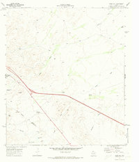 1970 Sotol Hill1973 Print · USGSReeves and Jeff Davis counties are shown here as they appeared in the early 1970s, defined by the isolated ranching outposts of West Texas. Researchers can trace historic land use through cattle-rearing infrastructure like Lether Ranch, Canyon Windmill, and Highway Tank.
 - 1970 Map of Fencepost Draw, 1973 Print
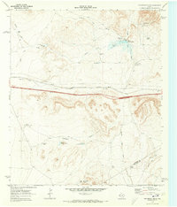 1970 Fencepost Draw1973 Print · USGSCulberson and Jeff Davis counties are captured here in the early seventies, showcasing a landscape defined by ranching outposts and railroad transit. Trace the Texas and Pacific line or locate remote camps like Fencepost and Middle Horse Camp Tank.
Showing maps 1-25 of 351
Top cities of Jeff Davis County
Frequently asked questions
- What are the different types of historical maps available for Jeff Davis County?
- What is the oldest map of Jeff Davis County?
- Where can I purchase historical maps of Jeff Davis County for my home or office?
- Where can I download high-res historical maps of Jeff Davis County?
- Are there historical topographic maps available for Jeff Davis County?
- Is there historical aerial imagery available for Jeff Davis County?
- Where are historical maps of Jeff Davis County sourced from?