2020s Maps of Jeff Davis County, Texas
Explore 54 historic maps of Jeff Davis County from the 2020s. These maps offer a rare glimpse into what life looked like during the 2020s — showing old roads, neighborhoods, homes, and landmarks that have changed or disappeared over time.
Whether you're researching your family's past, planning a metal detecting trip, or studying how Jeff Davis County's landscape evolved across the 2020s, these high-resolution maps are a powerful tool for exploring the history of this region.
- Focus on a specific era: All maps on this page are from the 2020s, giving you a focused view of this time period.
- See what’s changed: Compare century-old streets, trails, and buildings to today's modern landscape using overlays and satellite layers.
- Research with precision: Use these maps for genealogy, historical research, land use analysis, or educational projects.
- View, download, or print: Maps are fully viewable online in high resolution, and can be downloaded or printed for your own records.
Start exploring Jeff Davis County's history through authentic maps from the 2020s. This is your window into the past.
Jeff Davis County, TX maps
(54)- 2022 Map of Echo Canyon, 2022 Print
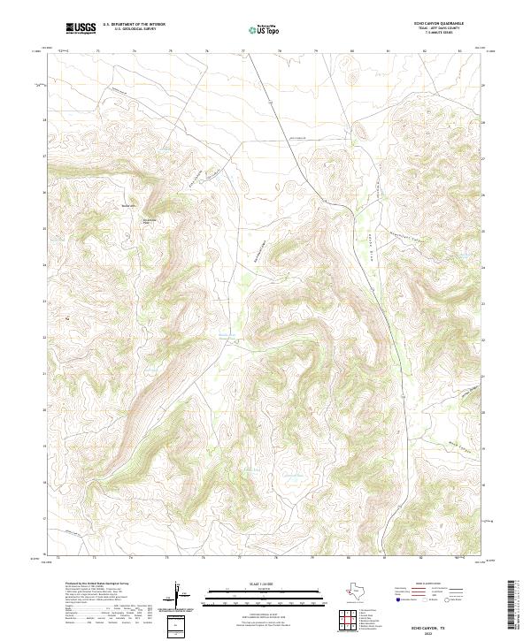 2022 Echo Canyon2022 Print · USGSHigh-altitude Texas ranching country is captured here in Jeff Davis County during the early twenty-first century. Researchers can trace land use through water features like Middle Rock House Tank and private access roads like Long X Ranch Rd.
 - 2022 Map of Lobo, 2022 Print
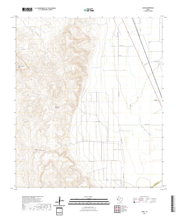 2022 Lobo2022 Print · USGSThe West Texas desert meets the high slopes of the Van Horn Mountains in this modern topographical study. Trace the remote settlement of Lobo and follow local ranching routes like Chispa Rd across the expansive Lobo Valley.
 - 2022 Map of Buckhorn Mountain, 2022 Print
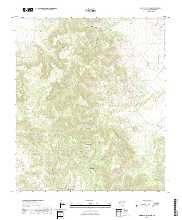 2022 Buckhorn Mountain2022 Print · USGSJeff Davis County's high-desert canyons and peaks are documented here in the early twenty-first century. Researchers can locate remote water sources like Dipping Vat Spring and follow the paths of 03 Ranch Rd past Buckhorn Mtn.
 - 2022 Map of Bennett Ranch, 2022 Print
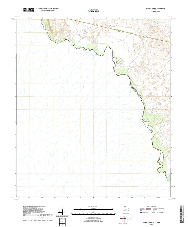 2022 Bennett Ranch2022 Print · USGSThe international border along the Rio Grande defines this remote West Texas landscape in the early twenty-first century. Researchers can trace the desert topography through features like Hog Canyon and locate scarce water sources at Ash Spring.
 - 2022 Map of Bare Mountain, 2022 Print
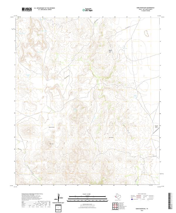 2022 Bare Mountain2022 Print · USGSHigh-altitude ranching and rugged topography define this section of Jeff Davis County in the modern era. Researchers can trace the essential water infrastructure of the high desert, from Twiford Spring to ranch landmarks like Rockpile Ranch Airport and Bare Mtn.
 - 2022 Map of Mayfield Hills, 2022 Print
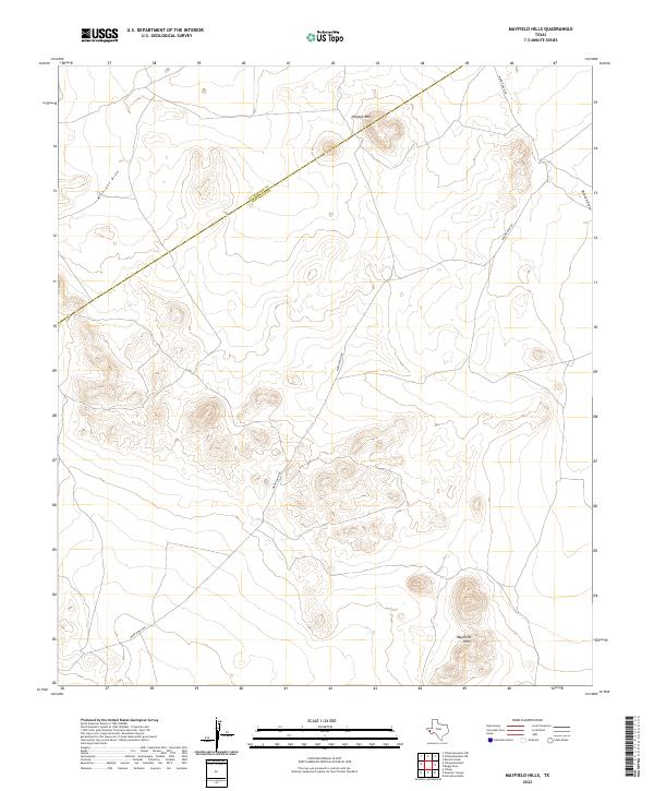 2022 Mayfield Hills2022 Print · USGSJeff Davis County at the edge of the Trans-Pecos is captured in this modern topographical study of the high desert. Researchers can trace ranching corridors along Moon Ranch Rd and locate prominent natural landmarks like Hogeye Mtn and the Mayfield Hills.
 - 2022 Map of Herds Pass, 2022 Print
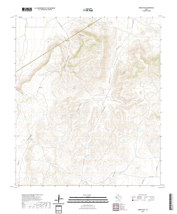 2022 Herds Pass2022 Print · USGSThe high desert country of Jeff Davis County comes to life in this survey of the rugged ranchlands along the Culberson County line. Researchers can trace historic water sources and landmarks like Herds Pass Spring, Horse Camp Peak, and Arp Flat.
 - 2022 Map of Valentine West, 2022 Print
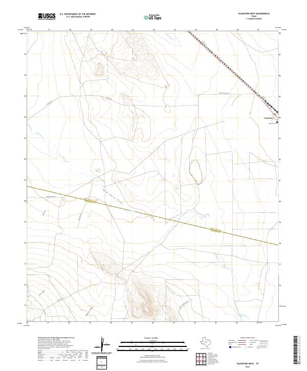 2022 Valentine West2022 Print · USGSThe Trans-Pecos ranchlands come into focus in this recent survey, centered on the remote community of Valentine. Genealogists and local historians can trace the Jeff Davis Co Presidio Co boundary and locate the Valentine Cem near the town site.
 - 2022 Map of El Muerto Peak, 2022 Print
 2022 El Muerto Peak2022 Print · USGSJeff Davis County in the modern era remains a landscape of high peaks and cattle ranching. You can trace family ranching land along Moore Ranch Rd or locate historic water sources like El Muerto Spring and the high summit of El Muerto Peak.
 - 2022 Map of Boggy Draw, 2022 Print
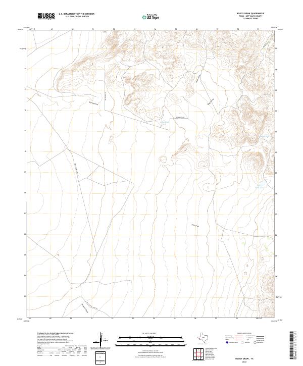 2022 Boggy Draw2022 Print · USGSJeff Davis County ranchland is mapped here in the early twenty-first century, showing a remote landscape shaped by water and wire. Genealogists and land historians can trace named infrastructure like Helm Ranch Rd and ranching landmarks like Lucky Tank or Dinkins Tank.
 - 2022 Map of Soldier Spring, 2022 Print
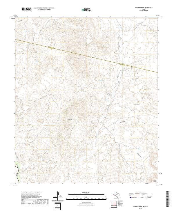 2022 Soldier Spring2022 Print · USGSThe high desert borderlands of Presidio and Jeff Davis counties come into focus in this 2022 survey of the Trans-Pecos region. Researchers can trace remote water sources like White Tank and Painted Spring or navigate the routes of Chispa Rd and Coal Mine Rd.
 - 2022 Map of San Antonio Pass, 2022 Print
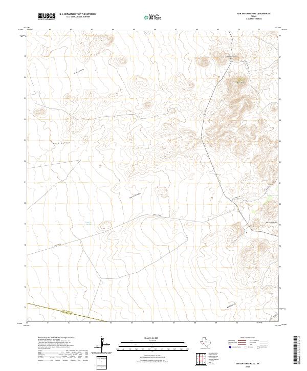 2022 San Antonio Pass2022 Print · USGSJeff Davis County ranch lands and high mountain passes are documented here in the early twenty-first century. Researchers can trace the topography of San Antonio Pass, the remote Bat Cave Canyon, and local landmarks like Buck Mtn.
 - 2022 Map of Paradise Mountain, 2022 Print
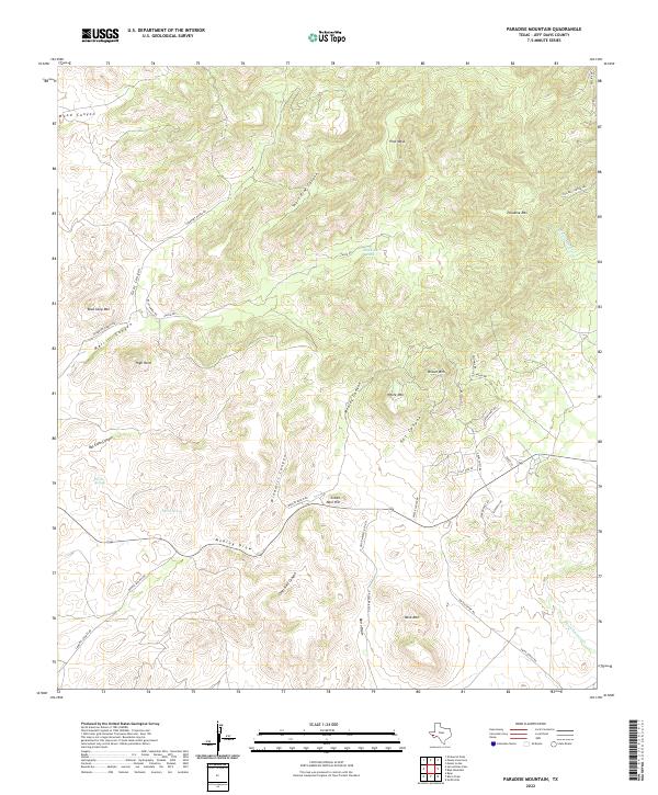 2022 Paradise Mountain2022 Print · USGSThis high-desert ranching territory in Jeff Davis County is shown at the start of the 2020s, highlighting a remote landscape of canyons and family-held lands. Researchers can trace historic water sources and rugged peaks including Barrel Springs, Paradise Mtn, and Mine Mtn.
 - 2022 Map of Mesquite Spring, 2022 Print
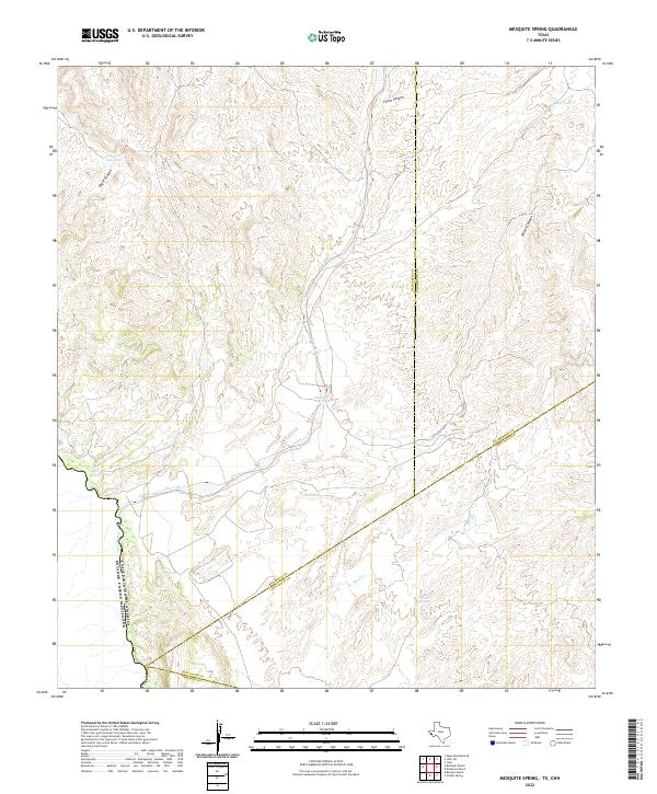 2022 Mesquite Spring2022 Print · USGSThe West Texas borderlands along the Rio Grande are captured here in the early twenty-first century, showing the intersection of four major counties. Researchers can trace water sources like Mesquite Spring and Catclaw Spring through the arid reaches of Eagle Canyon.
 - 2022 Map of Smith Hills, 2022 Print
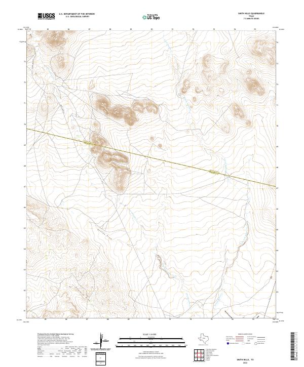 2022 Smith Hills2022 Print · USGSThe high-desert ranchlands of West Texas are documented here in the early twenty-first century, spanning the border of two counties. Researchers can trace the drainage of South Fork Alamito Creek and follow remote routes like Smith-Coffey Rd.
 - 2022 Map of Dowman Canyon, 2022 Print
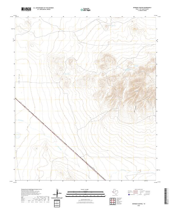 2022 Dowman Canyon2022 Print · USGSJeff Davis County's high desert landscape is recorded here in the early twenty-first century, showing the transition from the floor of Lobo Valley to the surrounding peaks. Researchers can trace vital water sources like Dagger Tank and follow the route of Tally Slough.
 - 2022 Map of Chispa, 2022 Print
 2022 Chispa2022 Print · USGSJeff Davis County during the early 2020s reveals a vast ranching landscape where the Lobo Valley floor meets the Sierra Vieja mountains. Trace early water sources and land routes near Ninetysix Spring, the Chispa settlement, and through the Ninetysix Gap.
 - 2022 Map of Robbers Roost Canyon, 2022 Print
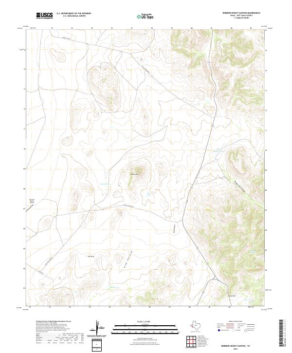 2022 Robbers Roost Canyon2022 Print · USGSHigh-altitude Texas ranching country in Jeff Davis County is preserved here in the early twenty-first century. Researchers can trace land use through naming patterns like Flattop Mtn and the strategic placement of stock ponds such as Crow Tank and Nunn Tank.
 - 2022 Map of Mount Livermore, 2022 Print
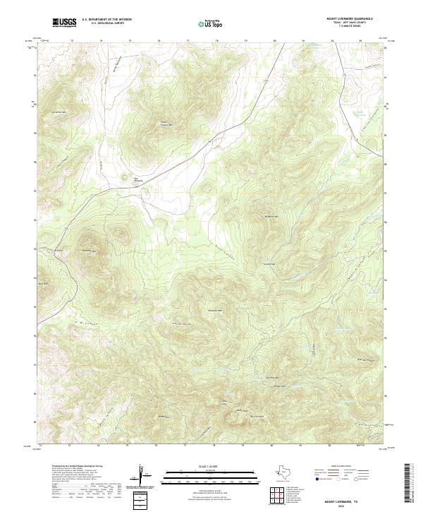 2022 Mount Livermore2022 Print · USGSHigh peaks and cattle-ranching infrastructure define this Jeff Davis County landscape in the 2020s. Hikers and historians can trace the Limpia Canyon Trl or locate landmark water sources like Beef Pasture Tank and Bridge Spring.
 - 2022 Map of Vieja Pass, 2022 Print
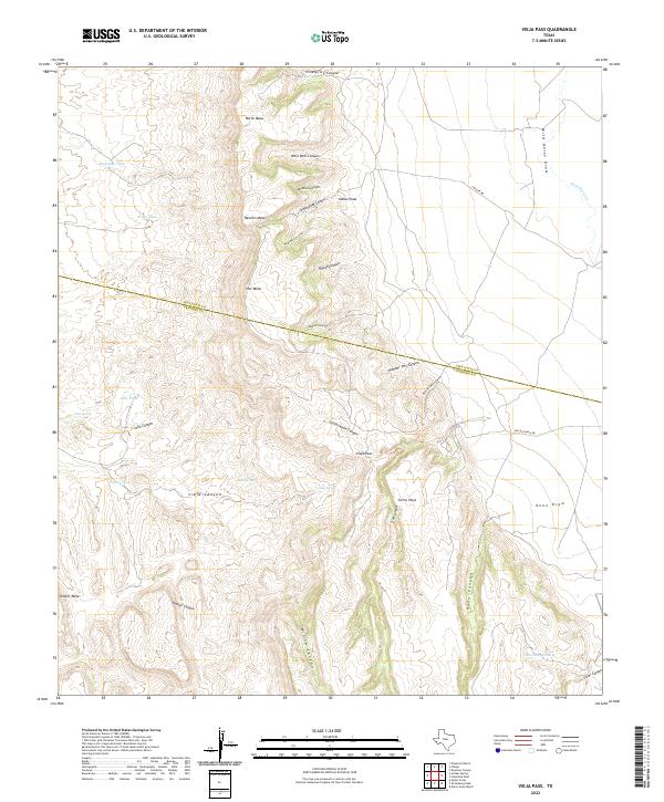 2022 Vieja Pass2022 Print · USGSThe Trans-Pecos high desert is captured here in the early twenty-first century, spanning the border of Jeff Davis and Presidio counties. Researchers can trace the water sources and landforms essential to desert ranching, from Vieja Spring and Bear Springs to the heights of Newton Mesa.
 - 2022 Map of Boracho Peak, 2022 Print
 2022 Boracho Peak2022 Print · USGSThe high desert boundary of Culberson and Jeff Davis counties is surveyed here in the early twenty-first century. Researchers can trace the rugged drainage patterns of Indian Waterhole Draw and locate family-named landmarks like Bronc Mule Hill and Boracho Peak.
 - 2022 Map of Mount Locke, 2022 Print
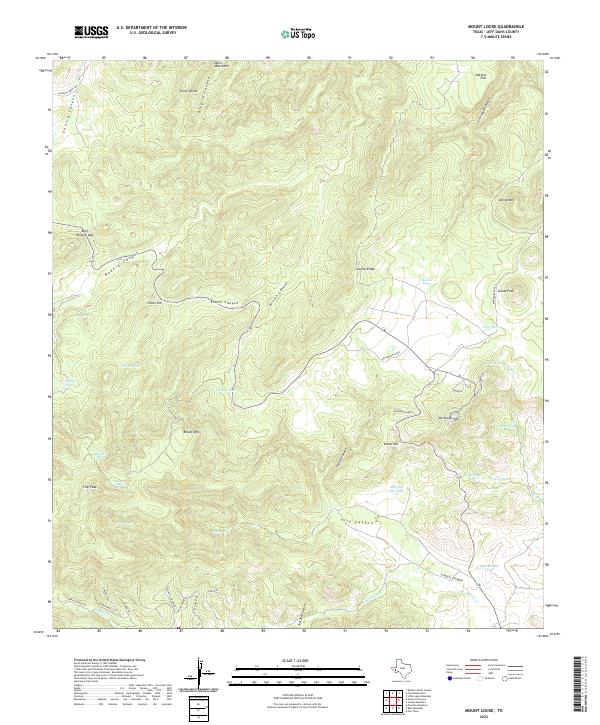 2022 Mount Locke2022 Print · USGSThe high Davis Mountains are captured here in the early twenty-first century, showcasing a landscape of high peaks and cattle ranching infrastructure. Researchers can trace the trails near Limpia Canyon and locate landmarks like the Eppenauer Ranch and Mt Locke.
 - 2022 Map of Horseshoe Butte, 2022 Print
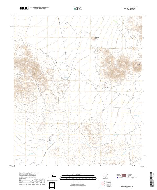 2022 Horseshoe Butte2022 Print · USGSJeff Davis County ranch lands are detailed here during the early twenty-first century, showing the essential water and road networks of the Trans-Pecos. Genealogists and historians can trace family-named routes like Alfred Means Ranch Rd and John Moore Rd alongside landmarks such as Horseshoe Butte.
 - 2022 Map of Burro Draw, 2022 Print
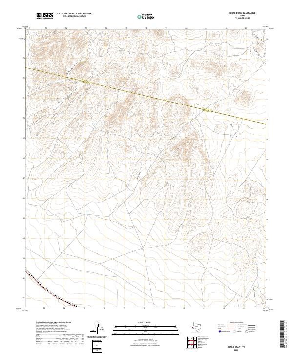 2022 Burro Draw2022 Print · USGSThe Trans-Pecos high desert at the start of the 2020s shows a landscape still defined by its natural drainage systems. Researchers can trace the ranching history of the borderlands through landmarks like Hughes Ranch Rd and the seasonal Burro Draw.
 - 2022 Map of Friend Mountain, 2022 Print
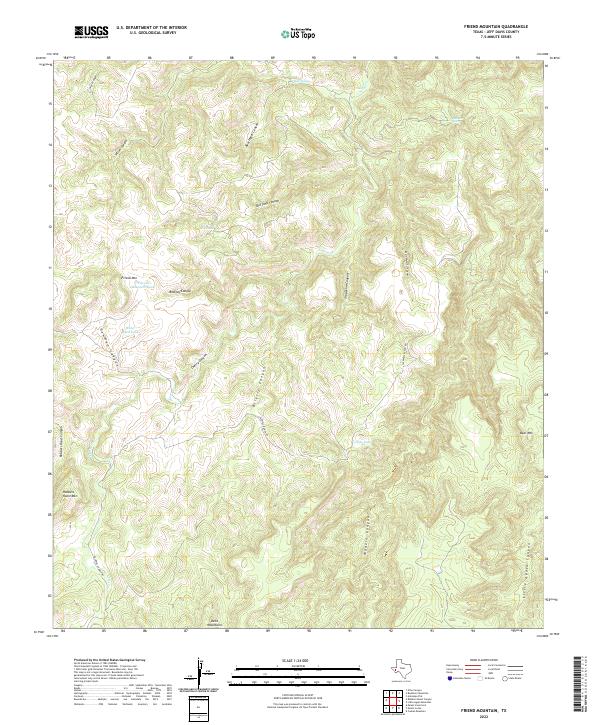 2022 Friend Mountain2022 Print · USGSThe Davis Mountains of West Texas are depicted in high detail during the early 2020s. Researchers can trace remote ranching routes along CALDWELL RANCH RD and locate vital water sources like Bonanza Spring and Friend Mountain Tank.
Showing maps 1-25 of 54
Top cities of Jeff Davis County
Frequently asked questions
- What are the different types of historical maps available for Jeff Davis County?
- What is the oldest map of Jeff Davis County?
- Where can I purchase historical maps of Jeff Davis County for my home or office?
- Where can I download high-res historical maps of Jeff Davis County?
- Are there historical topographic maps available for Jeff Davis County?
- Is there historical aerial imagery available for Jeff Davis County?
- Where are historical maps of Jeff Davis County sourced from?