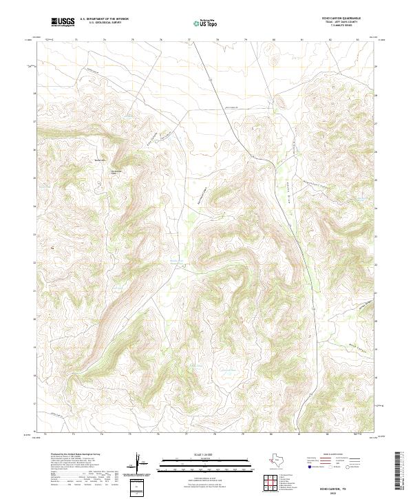
2022 Map of Echo Canyon
USGS Topo · Published 2022About this map
Round Mtn and Encantada Peak command the high ground of this Jeff Davis County landscape, where deep drainages like Echo Canyon and Rock House Canyon define the terrain. This modern survey illustrates a ranching environment where water management is critical to land use. Artificial water sources such as Middle Rock House Tank, Johnson Tank, and Brink Tank are strategically placed throughout the high country, supplementing natural features like Ash Spring and Hawthicket Spring.
Find a feature on this map
18 named features on this map. Tap any name to fly to it.
Don’t see what you’re looking for? This feature index may not catch every label — zoom into the map to look around manually.
Map Details
Editions of this 2022 Echo Canyon Map
This is the sole edition of this map. No revisions or reprints were ever made.
Other maps of this area

1894 · Valentine
USGS Topo · 1:125,000

1897 · Valentine
USGS Topo · 1:125,000

1928 · Kent
USGS Topo · 1:125,000

1943 · Valentine
USGS Topo · 1:125,000

1954 · Van Horn
USGS Topo · 1:250,000

1958 · Van Horn
USGS Topo · 1:250,000

1959 · Marfa
USGS Topo · 1:250,000

1965 · Marfa
USGS Topo · 1:250,000
1970 · Gomez Peak
USGS Topo · 1:24,000
1970 · Kent
USGS Topo · 1:24,000