1894 Map of Valentine
USGS Topo · Published 1959About this map
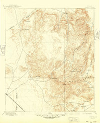
The Davis Mountains dominate this high-desert landscape in the Trans-Pecos region, as surveyed at the end of the nineteenth century by Henry Gannett and his team. The terrain is marked by prominent summits such as Mount Livermore, Sawtooth Mt., and El Muerto Peak, illustrating a land where elevation dictated the rhythms of life. At the foot of these ranges, the settlement of Valentine serves as a critical stop on the Southern Pacific Railroad, which cuts across the southwest corner of the map.
Find a feature on this map
26 named features on this map. Tap any name to fly to it.
Don’t see what you’re looking for? This feature index may not catch every label — zoom into the map to look around manually.
Map Details
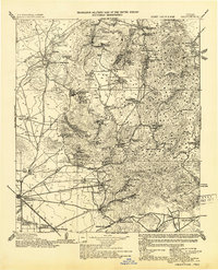
Editions of this 1894 Valentine Map
This is the sole edition of this map. No revisions or reprints were ever made.
Historical Maps of Valentine Through Time
3 maps found