1943 Map of Valentine
USGS Topo · Published 1943About this map
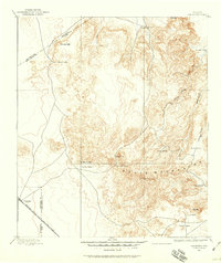
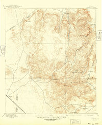
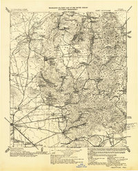
Valentine serves as the primary rail hub on this high-desert ranching landscape, situated along the Southern Pacific RR as it cuts across the southern portion of the sheet. The territory is defined by an extensive network of family-held cattle operations, from the Reynolds Ranch Hdqrs. in the north to the Merrill's Ranch in the southeast. These isolated holdings relied on a complex system of water management, evidenced by numerous labeled features like Nunns Cistern, Cement Tank, and the Finley Windmills.
Find a feature on this map
91 named features on this map. Tap any name to fly to it.
Don’t see what you’re looking for? This feature index may not catch every label — zoom into the map to look around manually.
Map Details
Editions of this 1943 Valentine Map
This is the sole edition of this map. No revisions or reprints were ever made.
Historical Maps of Valentine Through Time
3 maps found