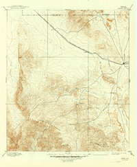
1895 Map of Marfa
USGS Topo · Published 1949About this map
The Marfa plateau of the Big Bend region is defined here by the convergence of early rail travel and ranching outposts. Based on an 1893 survey by R.O. Gordon, the map illustrates the Southern Pacific railroad line, operated as the Galveston, Harrisburg and San Antonio Division, cutting across Ryan Flat. Along this corridor, small stops like Aragon and Ryan serve as essential hubs for a landscape dominated by livestock and geography. To the south, the topography transitions into the dramatic heights of Cuesta Del Burro and the Cleveland Breaks. Early cattle operations and water points are documented through sites like Porter's Ranch, Humphris, and the Stage Stand, marking the logistical realities of high-desert life before modern infrastructure. Drainage systems like Alamito Creek and Saucita Creek provided the necessary lifelines for these remote Presidio County settlements.
Find a feature on this map
25 named features on this map. Tap any name to fly to it.
Don’t see what you’re looking for? This feature index may not catch every label — zoom into the map to look around manually.
Map Details
Editions of this 1895 Marfa Map
5 editions found
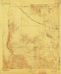
Other maps of this area

1892 · Chispa
USGS Topo · 1:125,000

1894 · Valentine
USGS Topo · 1:125,000

1894 · Fort Davis
USGS Topo · 1:125,000

1895 · Chispa
USGS Topo · 1:125,000

1895 · Marfa
USGS Topo · 1:125,000

1895 · Alpine
USGS Topo · 1:125,000

1896 · Ruidosa
USGS Topo · 1:125,000

1896 · San Carlos
USGS Topo · 1:125,000

1896 · Shafter
USGS Topo · 1:125,000

1897 · Valentine
USGS Topo · 1:125,000