1959 Map of Presidio
USGS Topo · Published 1981About this map
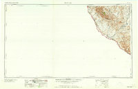
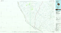
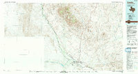
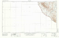
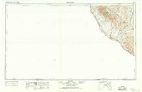
The Chinati Mountains dominate this 1959 survey of the High Desert borderlands, rising sharply above the river valley. The Rio Grande serves as the international boundary, with small riverside settlements such as Indio, Adobes, and Redford punctuating the landscape. This era represents a period of quiet transition for Presidio County, where the mining legacy of the Shafter Mine and Last Chance Mine remains visible even as the regional economy shifted. Transport and logistics are central to the map's layout, showing the Orozimbo Siding and a Border patrol station near the historic Fort Leaton (site). Numerous unnamed Ranch labels and family-associated locations like Casa Piedra reflect a landscape defined by cattle and wide-ranging landholdings. In the southeast, the complex geology of Solitario Canyon begins to emerge, while the Cienega Mountains anchor the interior geography.
Find a feature on this map
29 named features on this map. Tap any name to fly to it.
Don’t see what you’re looking for? This feature index may not catch every label — zoom into the map to look around manually.
Map Details
Editions of this 1959 Presidio Map
2 editions found
Historical Maps of Presidio Through Time
4 maps found