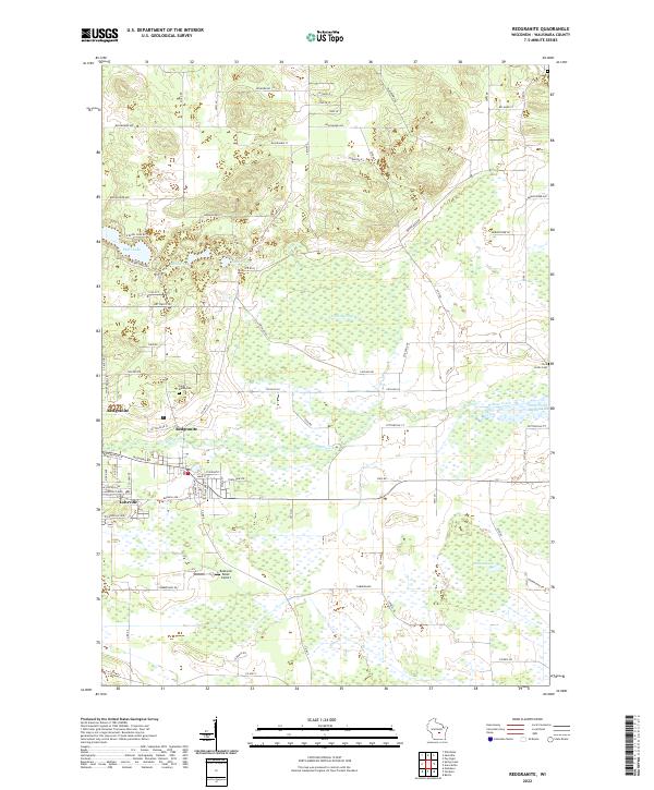
2022 Map of Redgranite
USGS Topo · Published 2022About this map
Redgranite and the adjacent village of Lohrville serve as the primary hubs in this section of Waushara County, situated among a landscape defined by glacial lakes and meandering waterways. The area is marked by several prominent water bodies including Pearl Lake, Middle Lake, and Taylor Lake to the west, while the Auroraville Millpond sits to the east, fed by Willow Creek. This 2022 survey illustrates a mix of residential blocks and rural tracts, with local landmarks like Buzzards Roost Airport providing evidence of small-scale aviation infrastructure. Genealogists and local historians will find the locations of Saint Marks Cem and Pine Grove Cem particularly useful for identifying family sites within the townships of t18n r12e and t19n r12e. The intricate network of county roads, such as Co Hwy E and Co Rd SS, connects these small communities to the surrounding marshlands and agricultural fields.
Find a feature on this map
64 named features on this map. Tap any name to fly to it.
Don’t see what you’re looking for? This feature index may not catch every label — zoom into the map to look around manually.
Map Details
Editions of this 2022 Redgranite Map
This is the sole edition of this map. No revisions or reprints were ever made.
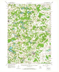
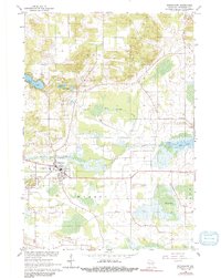
Historical Maps of Warren Through Time
3 maps found