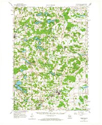
1961 Map of Redgranite
USGS Topo · Published 1966About this map
Glacial lakes and small rural communities dot this pocket of central Wisconsin, where the village of Redgranite serves as a hub of activity near the Chicago and North Western railroad line. The landscape is defined by its recreation and industry, featuring numerous youth camps such as Camp Talaki, Camp Hiwela, and Camp Lucerne alongside active extractive sites like the Quarry in Lohrville. In the northwest, the State Fish Hatchery and Wild Rose Municipal Airport sit just outside Wild Rose, while the winding Pine River and Willow Creek drain the surrounding marshes and swamps.
Find a feature on this map
84 named features on this map. Tap any name to fly to it.
Don’t see what you’re looking for? This feature index may not catch every label — zoom into the map to look around manually.
Map Details
Editions of this 1961 Redgranite Map
2 editions found

Other maps of this area

1915 · Neshkoro
USGS Topo · 1:48,000

1916 · Ripon
USGS Topo · 1:48,000

1918 · Neshkoro
USGS Topo · 1:62,500

1918 · Ripon
USGS Topo · 1:62,500

1955 · Green Bay
USGS Topo · 1:250,000

1956 · Ripon
USGS Topo · 1:62,500

1956 · Weyauwega
USGS Topo · 1:48,000

1957 · Amherst
USGS Topo · 1:48,000

1957 · Waupaca
USGS Topo · 1:48,000

1957 · Madison
USGS Topo · 1:250,000