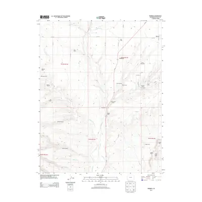
2013 Map of Redmesa
USGS Topo · Published 2013About this map
The La Plata River winds through this high-altitude landscape of southwestern Colorado, defining a territory where water management is central to the local geography. Human adaptation to the arid environment is evidenced by the systems of the Pioneer Ditch and Enterprise Ditch, which divert water to sustain the small settlements of Redmesa and Marvel. These communities are surrounded by a complex network of geological formations, including the prominent Red Mesa and the volcanic features of Cinder Bluffs and South Cinder Butte.
Find a feature on this map
50 named features on this map. Tap any name to fly to it.
Don’t see what you’re looking for? This feature index may not catch every label — zoom into the map to look around manually.
Map Details
Editions of this 2013 Redmesa Map
This is the sole edition of this map. No revisions or reprints were ever made.
Other maps of this area

1889 · Chaco
USGS Topo · 1:250,000

1892 · Chaco
USGS Topo · 1:250,000

1912 · Soda Canyon
USGS Topo · 1:62,500

1913 · Red Mesa
USGS Topo · 1:62,500

1915 · Soda Canyon
USGS Topo · 1:62,500

1954 · Shiprock
USGS Topo · 1:250,000

1956 · Cortez
USGS Topo · 1:250,000

1958 · Cortez
USGS Topo · 1:250,000

1958 · Shiprock
USGS Topo · 1:250,000

1959 · Shiprock
USGS Topo · 1:250,000