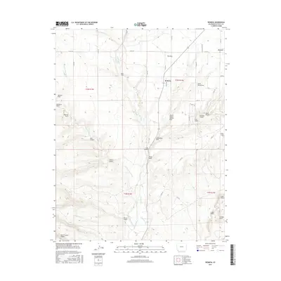
2016 Map of Redmesa
USGS Topo · Published 2016About this map
The Red Mesa plateau dominates this Southwestern Colorado landscape, centered around the rural communities of Redmesa and Marvel near the New Mexico border. Water management is a central theme of this high-desert region, evidenced by the La Plata River and an intricate network of irrigation systems including the Pioneer Ditch and Enterprise Ditch. These human-made waterways run parallel to natural drainages such as Johnny Pond Arroyo and San Juan Arroyo, illustrating the transition from natural runoff to controlled agricultural irrigation.
Find a feature on this map
51 named features on this map. Tap any name to fly to it.
Don’t see what you’re looking for? This feature index may not catch every label — zoom into the map to look around manually.
Map Details
Editions of this 2016 Redmesa Map
This is the sole edition of this map. No revisions or reprints were ever made.
Other maps of this area

1889 · Chaco
USGS Topo · 1:250,000

1892 · Chaco
USGS Topo · 1:250,000

1912 · Soda Canyon
USGS Topo · 1:62,500

1913 · Red Mesa
USGS Topo · 1:62,500

1915 · Soda Canyon
USGS Topo · 1:62,500

1954 · Shiprock
USGS Topo · 1:250,000

1956 · Cortez
USGS Topo · 1:250,000

1958 · Cortez
USGS Topo · 1:250,000

1958 · Shiprock
USGS Topo · 1:250,000

1959 · Shiprock
USGS Topo · 1:250,000