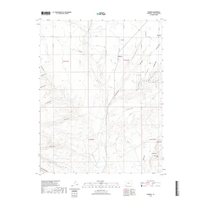
2019 Map of Redmesa
USGS Topo · Published 2019About this map
Redmesa and the nearby community of Red Mesa anchor this landscape in southwestern La Plata County, where the high desert terrain is carved by the La Plata River and its numerous tributary draws. The map illustrates a century of water management in a semi-arid region, featuring essential infrastructure like the Pioneer Ditch and Enterprise Ditch. These irrigation channels are critical to the agricultural life found near Marvel in the northeast. The topography is defined by a dense network of erosional features, including Church Hollow, Bragg Draw, and Silva Draw. In the southeast, volcanic geology becomes prominent with Cinder Butte, Cinder Bluffs, and South Cinder Butte rising above the surrounding flats. A systematic grid of county roads, such as Co RD 100 and Co RD 105, connects isolated farmsteads and ranchlands across the township and range divisions of T33N and T32N.
Find a feature on this map
51 named features on this map. Tap any name to fly to it.
Don’t see what you’re looking for? This feature index may not catch every label — zoom into the map to look around manually.
Map Details
Editions of this 2019 Redmesa Map
This is the sole edition of this map. No revisions or reprints were ever made.
Other maps of this area

1889 · Chaco
USGS Topo · 1:250,000

1892 · Chaco
USGS Topo · 1:250,000

1912 · Soda Canyon
USGS Topo · 1:62,500

1913 · Red Mesa
USGS Topo · 1:62,500

1915 · Soda Canyon
USGS Topo · 1:62,500

1954 · Shiprock
USGS Topo · 1:250,000

1956 · Cortez
USGS Topo · 1:250,000

1958 · Cortez
USGS Topo · 1:250,000

1958 · Shiprock
USGS Topo · 1:250,000

1959 · Shiprock
USGS Topo · 1:250,000