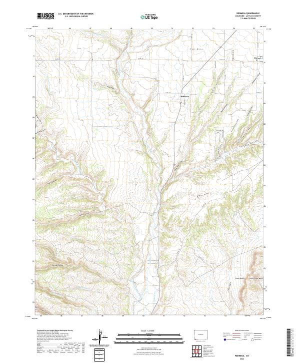
2022 Map of Redmesa
USGS Topo · Published 2022About this map
Redmesa and the high plains of southwestern La Plata County define this survey, where the La Plata River carves a deep path through the plateau. This landscape is a complex network of arid drainage systems, featuring named draws and hollows such as Church Hollow, Butch Henry Draw, and Mooney Draw. The settlement of Marvel sits on the eastern edge of the quadrangle, connected to the surrounding ranching and farming landscape by a grid of county roads.
Find a feature on this map
51 named features on this map. Tap any name to fly to it.
Don’t see what you’re looking for? This feature index may not catch every label — zoom into the map to look around manually.
Map Details
Editions of this 2022 Redmesa Map
This is the sole edition of this map. No revisions or reprints were ever made.
Other maps of this area

1889 · Chaco
USGS Topo · 1:250,000

1892 · Chaco
USGS Topo · 1:250,000

1912 · Soda Canyon
USGS Topo · 1:62,500

1913 · Red Mesa
USGS Topo · 1:62,500

1915 · Soda Canyon
USGS Topo · 1:62,500

1954 · Shiprock
USGS Topo · 1:250,000

1956 · Cortez
USGS Topo · 1:250,000

1958 · Cortez
USGS Topo · 1:250,000

1958 · Shiprock
USGS Topo · 1:250,000

1959 · Shiprock
USGS Topo · 1:250,000