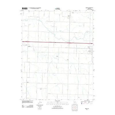
2011 Map of Reeds
USGS Topo · Published 2011About this map
Center Creek and Jenkins Creek define the agricultural landscape of eastern Jasper County, where small agricultural crossroads and family cemeteries anchor the rural community. The city of Sarcoxie occupies the eastern edge of the map, served by a network of farm-to-market roads including Cimarron Rd and Apple Rd. Smaller named localities such as Motley, Parshley, and Pepsin represent the enduring settlement patterns of the Ozark plateau. Several burial grounds, including the Reeds Cemetery, Motley Cemetery, and Powers Cemetery, provide significant points of interest for genealogists tracing local families. The map illustrates a landscape of organized section lines and creek-fed valleys, with the northern village of Reeds situated near the intersection of several county roads and the winding path of Motley Branch.
Find a feature on this map
72 named features on this map. Tap any name to fly to it.
Don’t see what you’re looking for? This feature index may not catch every label — zoom into the map to look around manually.
Map Details
Editions of this 2011 Reeds Map
This is the sole edition of this map. No revisions or reprints were ever made.
Other maps of this area

1886 · Carthage
USGS Topo · 1:125,000

1894 · Carthage
USGS Topo · 1:125,000

1916 · Neosho
USGS Topo · 1:62,500

1921 · Sarcoxie
USGS Topo · 1:62,500

1943 · Ritchey
USGS Topo · 1:62,500

1947 · Joplin
USGS Topo · 1:250,000

1949 · Joplin
USGS Topo · 1:250,000

1954 · Tulsa
USGS Topo · 1:250,000

1954 · Joplin
USGS Topo · 1:250,000

1958 · Joplin
USGS Topo · 1:250,000