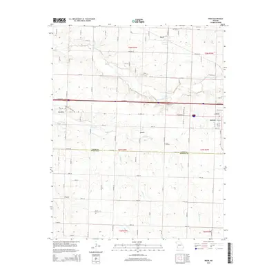
2015 Map of Reeds
USGS Topo · Published 2015About this map
Sarcoxie and the rural communities of Jasper and Newton Counties define this landscape in the early 21st century. The map centers on a series of small, scattered settlements including Reeds, Motley, and Parshley, revealing a pattern of agricultural development interspersed with named cemeteries that provide critical clues for local genealogy. The boundary between Jasper Co and Newton Co runs through the lower third of the quadrangle, where the terrain is drained by several waterways, most notably Center Creek and its southern tributaries like Jenkins Cr and Motley Br. Transportation is dominated by the modern corridor of Cimarron Ln, while a dense network of county roads like Dogwood Rd and Beech RD connects isolated farms and the community of Pepsin. Researchers will find the locations of Powers Cemetery, Gem Cemetery, and Sarcoxie Cemetery useful for documenting the region's burial history and family landholdings.
Find a feature on this map
81 named features on this map. Tap any name to fly to it.
Don’t see what you’re looking for? This feature index may not catch every label — zoom into the map to look around manually.
Map Details
Editions of this 2015 Reeds Map
This is the sole edition of this map. No revisions or reprints were ever made.
Other maps of this area

1886 · Carthage
USGS Topo · 1:125,000

1894 · Carthage
USGS Topo · 1:125,000

1916 · Neosho
USGS Topo · 1:62,500

1921 · Sarcoxie
USGS Topo · 1:62,500

1943 · Ritchey
USGS Topo · 1:62,500

1947 · Joplin
USGS Topo · 1:250,000

1949 · Joplin
USGS Topo · 1:250,000

1954 · Tulsa
USGS Topo · 1:250,000

1954 · Joplin
USGS Topo · 1:250,000

1958 · Joplin
USGS Topo · 1:250,000