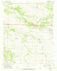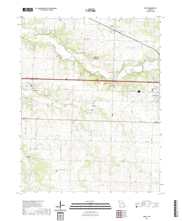
2021 Map of Reeds
USGS Topo · Published 2021About this map
Reeds and the surrounding farm country of eastern Jasper County are captured here in the early 2020s, a landscape defined by its grid of rural roads and scattered small communities. The area is intersected by the winding path of Center Creek, which flows westward past Parshley toward the northern reaches of the Jasper Co Newton Co border. Local heritage is deeply rooted in its numerous burial grounds, including the Dudman Springs Church Cem and Whitaker Cem, which serve as permanent records of the region's early families. To the east, the edge of Sarcoxie appears, while small hamlets like Motley and Pepsin punctuate the southern landscape. This modern survey illustrates how long-established aviation sites like Nimsick Airport and traditional rural post-office settlements persist alongside contemporary thoroughfares like Cimarron Ln.
Find a feature on this map
78 named features on this map. Tap any name to fly to it.
Don’t see what you’re looking for? This feature index may not catch every label — zoom into the map to look around manually.
Map Details
Editions of this 2021 Reeds Map
This is the sole edition of this map. No revisions or reprints were ever made.